

Rainbow Falls Trail - Mount Le Conte
The Adventure Guide to Rainbow Falls includes a trail description of the Rainbow Falls Trail, photographs of the Rainbow Falls Trail, comments from our hikes, mileage data for the Rainbow Falls Trail, the Mount Le Conte topo map, and Rainbow Falls Trail GPS tracklogs. The guide will familiarize you with the Rainbow Falls Trail and Mount Le Conte and help you on your climb.
Date Climbed: 20Feb11, revised 07Feb13
Elevation: 6,593', Net Gain: 4,043'
Range: Smoky Mountain National Park
107 Park Headquarters Road
Gatlinburg, TN 37738
(865) 436-1200
Trailhead Latitude: 35.67567, Longitude: 83.48567
Route: Rainbow Falls Trail
One-Way Mileage: 6.5, from trailhead to Le Conte Lodge
For Map, Trail Mileage, GPS, and Trail Notes go to Page 2
The Climb
Directions: In Gatlinburg, TN the traffic lights are numbered. Light number 6 is Cherokee Orchard Road and number 8 is Airport Road. Either road leads to a Y where the two roads join into one and become Cherokee Orchard Road. The trailhead is about 3.5 miles from main Gatlinburg road - Parkway or by number - 421.

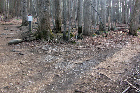
Trailhead signs across from the restrooms - 2,550'
The Rainbow Falls Trail begins across from the restrooms on the other side of the parking lot near trail signs.
Unmarked Y, go left for Rainbow Falls
Just up from the trailhead there is a Y junction. To the right is an unmarked path that leads to the Old Sugarland Trail (gravel road) and on to the Bull Head Trail. The Rainbow Falls Trail stays slightly left and uphill.
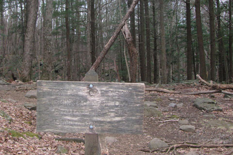
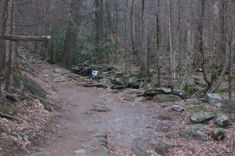
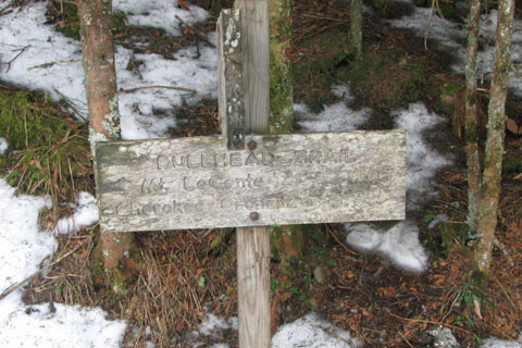
Trillium Gap/Bull Head Junction
About a hundred yards from the trailhead the trail comes to a marked junction. Now there are more signs than you need! At the intersection to the right leads to the Old Sugarland Trail (gravel road) and on to the Bull Head Trail, to the left goes to the Trillium Gap Trail, and straight ahead takes you up the mountain.
First switchback as the trail leaves the creek
The trail gives a good view of Le Conte Creek and then turns away for a set of short switchbacks after .10 mile from the trailhead. Remember to always stay on the trail. Never shortcut a switchback.
Trail follows the creek
The Rainbow Falls Trail climbs at an easy grade as it follows close to the creek. At .55 mile is the second set of switchbacks.
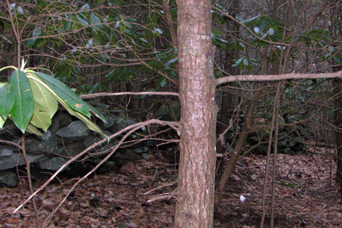
Stone fence just off the right side of the trail - .95m, 3,100'
Returning to the creek the trail curves along for .40 mile. At just above 3100 feet in elevation is an old stone fence tucked under some rhododendron. The fence is almost one mile from the trailhead.
Starting another set of switchbacks above the fence
Another set of switchbacks go to the left after the fence. After the trail straightens out, it stays high above the creek for the next .40 mile.
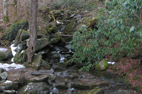
Lower creek crossing - 1.80m, 3,700'
A few curves lead to the lower creek crossing, 1.80 miles from the trailhead (3700').
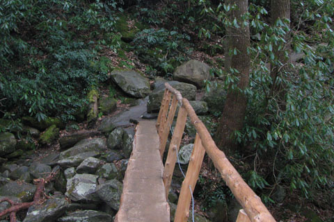
Bridge over Le Conte Creek
Cross the creek on the bridge. All of the creek crossings require can be dangerous. Use caution, even on the bridges.
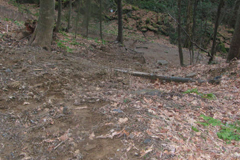
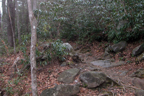
Shortcut damage at a switchback
The switchbacks climb between branches of the creek. On the third switchback there was evidence of shortcutting. The hikers were strong enough to attempt the trail but evidently not strong enough to stay on the trail.
Small falls
The path climbs next to one of the forks of the creek and crosses the creek beneath a small falls, .60 mile from the lower creek crossing.
Second crossing of Le Conte Creek
Another small creek is crossed and then the main fork of Le Conte creek is crossed again, on a bridge. This crossing is .80 mile from the lower crossing.
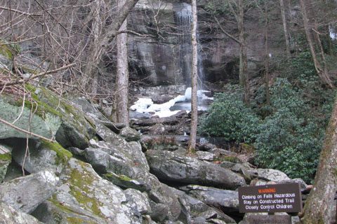
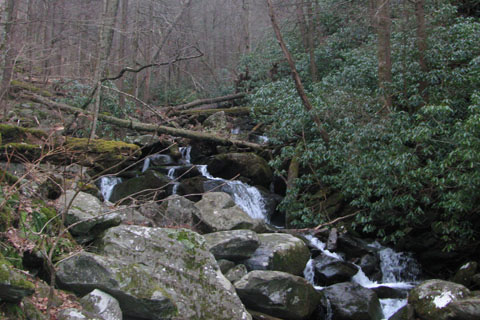
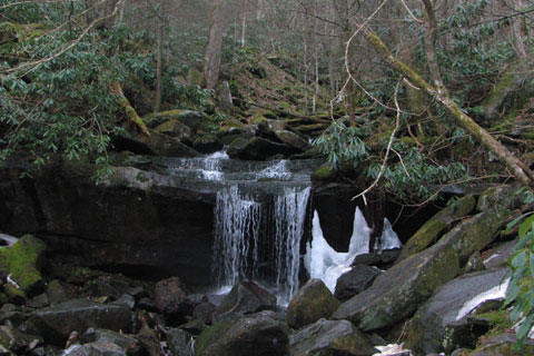
Rainbow Falls - 2.80m, 4,200'
A short distance further and the trail comes to the base of Rainbow Falls (about 4200').
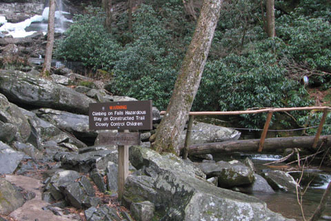
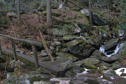
Bridge at the Falls
The bridge is 2.80 miles from the trailhead.
Upper crossing, last one! - 3.30m, 4,500'
Above Rainbow Falls the trail is less traveled. Another drainage is crossed and a curve or switchback crosses the drainage again. A very short set of switchbacks are reached at .30 mile from the Falls. The trail then contours over to the Upper Creek Crossing at .50 mile from the Falls.
The trail leaves Le Conte Creek for good. Traversing to the north the trail heads for Rocky Spur (ridge).
Rock Gap - 3.80m, 4,800'
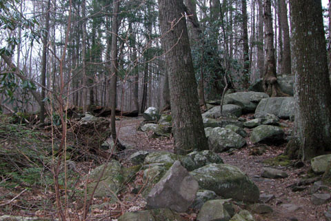
In .20 mile the trail curves back right and begins a short set of switchbacks. Continuing the trail reaches Rock Gap (a small cliff on one side of the cliff and a boulder on the other) at .50 mile from the upper creek crossing.
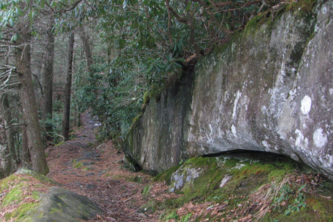
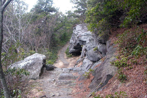
Arching Rock Wall - 4.05m, 5,000'
In a short distance (.05) the trail crosses the ridge crest and continues on the north side of the spur heading east. A unique Rock Wall arches forward next to the trail. It is .20 mile from the ridge (4.05m from the trailhead).
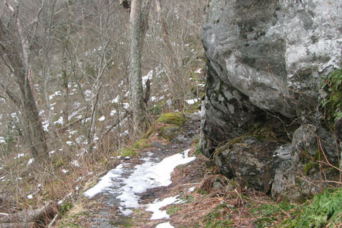
Tree/Rock Squeeze - 4.65m, 5200'
Staying on the north side of the ridge the trail continues heading east for .60 miles until it reaches a Tree/Rock Squeeze - the trail threads between the cliff and a tree. The squeeze is more obvious when climbing than descending.
Exposed slab near the Switchback - 4.85 m
.20 mile from the tree/rock squeeze is a sharp switchback. This is 1.00 mile from the Rocky Spur Ridge. An exposed rock slab helps distinguish the slope just after the turn.
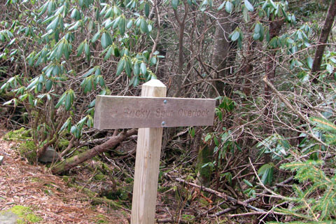
Rocky Spur side trail junction 5.35m, 5,650'
From the switchback the trail climbs steadily as it heads westerly toward the Rocky Spur Ridge again. There are a few small viewpoints along the way before the trail crosses the ridge and curves to the east. At .50 mile the first Rocky Spur side trail is reached. The side trail adds about .25 miles to the trail. The trail is not difficult; but it is a side trail. It does not take you to the summit.
Bull Head Junction - 5.95m, 6,000'
Staying on the main trail the Spur rejoins the trail in a few hundred feet. Now, it is only .60 mile to the junction with the Bull Head Trail at 6000' elevation (5.95 miles from the trailhead). See notes on page 2 for a mileage note.
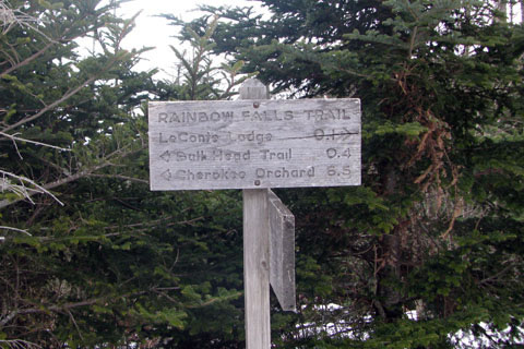
Alum Cave Junction - 6.35m
At the signed junction, the trail to the summit goes left. The wonderful trail climbs gradually to the junction with the Alum Cave Trail in .40 mile. The junction is well signed.
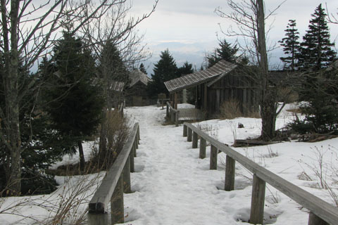
Le Conte Lodge
Continuing straight the trail passes the Le Conte Lodge and reaches Trillium Gap Trail in .10 mile. At the Le Conte Lodge there are privies for hikers use. Various amenities are available at the Lodge.
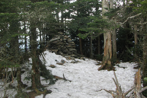
High Top, Le Conte's summit - 6.80m, 6,593'
Back on the route to the summit, the path will junction with the Trillium Gap Trail and a spring (water) directional sign, then the Cliff Top side trail, the backpackers shelter, and finally High Top, the summit at 6,593' elevation. It is about .40 mile (.35 mile from Trillium Trail Junction) from the lodge to the summit. The summit is a large stack of rocks (cairn) to the right of the trail. There are no views from the summit.
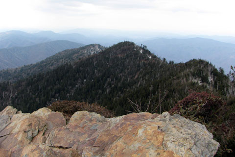
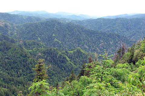
View from Cliff Tops
Returning toward the Lodge, the Cliff Tops Trail is a worthy side trip with great views to the north and west.
To return to the trailhead, reverse the Rainbow Falls Trail, or make a loop with the Bull Head Trail (it is about .50 miles longer than Rainbow Falls). The Trillium Gap Trail is also possible; but it is adds over 3 miles to return to the Rainbow Falls Trailhead.