

The Loch, Glass Lake, Sky Pond -
Rocky Mountain National Park
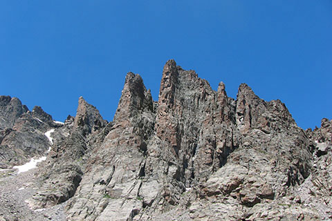
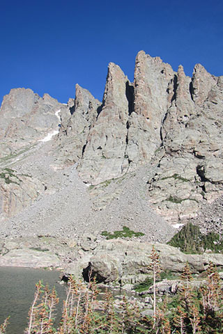
Cathedral Peaks from Sky Pond
The Trail Guide to The Loch, Glass Lake, and Sky Pond includes trail descriptions, photographs of the trails, comments from our hikes, mileage data, custom topo map, and the routes tracklog on a geo-pdf map. The guide will familiarize you with The Loch, Glass Lake, and Sky Pond Trails. We hope the guide helps you on your hikes and adventures.
Route Data
Photos from: July 2010, 2014
Glacier Gorge Trailhead Elevation: 9,240'
Range: Rocky Mountain National Park
Map Coordinate System - Geodetic Base (NAD83)
Trailhead Latitude: 40.310658, Longitude: -105.640174
Route: Glacier Gorge Trail, The Loch Trail, Sky Pond Trail
One Way Distance: 4.90 miles
For Map, Trail Mileage, GPS, and Trail Notes go to Page 2
Route Comments
Sky Pond is a small Alpine Lake about 5 miles from the Glacier Gorge Trailhead. The lake has a magical name befitting the scenery.
Many times we have laced our shoes, shouldered our packs and found our way to Sky Pond. We have never grown tired of the route or the destination.
The Hike
Directions: From Estes Park, enter Rocky Mountain National Park at the Beaver Meadows Entrance (Hwy 36 - Moraine Ave). A short distance beyond the entrance turn left (south) on Bear Lake Road. Follow Bear Lake Road for 8.40 miles to Glacier Gorge Trailhead. Buses operate in the summer season to ease parking difficulties.
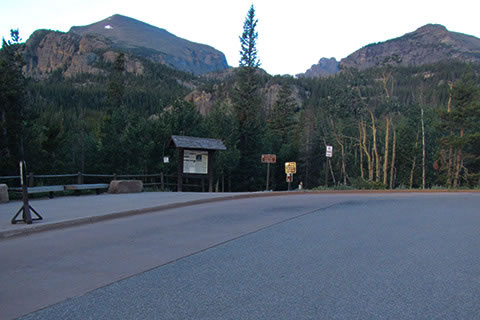
The Glacier Gorge Trailhead has privies, a bus stop, a trailhead information kiosk, and limited parking. The parking fills rather quickly hence the need for the bus stop.
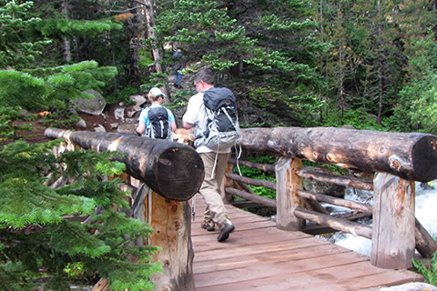
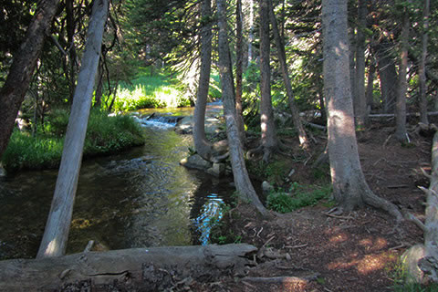
The trail descends to cross Chaos Creek on a large bridge.
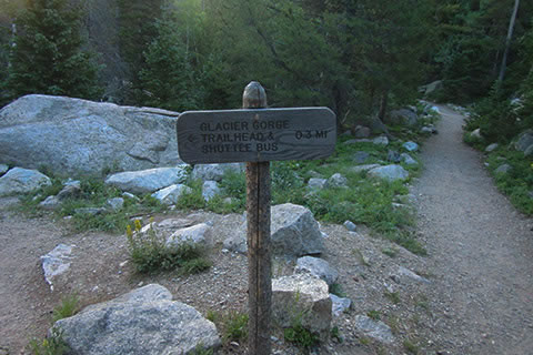
After crossing the creek, the trail climbs to the junction with Glacier Creek Trail. At each trail junction along the route, the National Park Service (NPS) has directional signs. It is wise to talk a second and read the signs, just to make sure you are where you think that you are! Turn right at the junction and continue uphill.
In a short distance the trail reaches another junction. To the right the trail leads to Bear Lake Trailhead and to the left is the Glacier Gorge Trail to Alberta Falls. Follow the Glacier Gorge Trail.
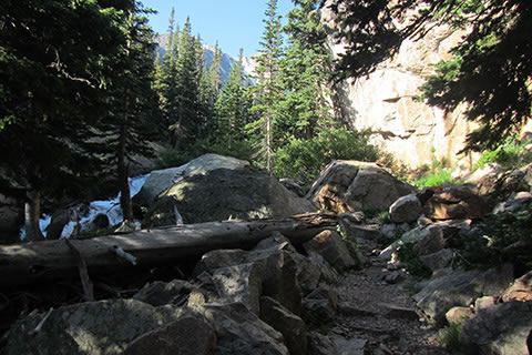
The wide trail narrows to cross a creek on a footbridge and then climbs steadily toward the falls.
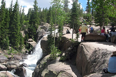
At .60 mile the Glacier Gorge Trail (.90 from the trailhead) reaches Alberta Falls. The area is an attraction and sees a lot of traffic. Of course if you walk the path at sunrise (or earlier), there are far less folks crowded around the falls and on the trail.
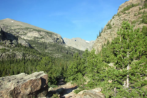
Leaving the falls, the trail climbs through switchbacks toward the Glacier Knobs. To ease the pain of the climb, there are great views of the valley and the mountains.
At .90 mile from Alberta Falls and 1.80 miles from the Glacier Gorge Trailhead, the trail reaches the junction with the North Longs Peak Trail.
From the junction, the climb eases along a bench above Glacier Creek.
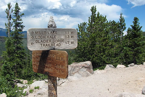
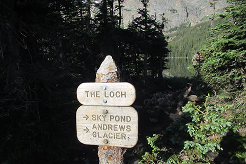
After about .50 mile from the North Longs Peak Trail, the trail descends to a saddle between the Glacier Knobs and a major junction. Glacier Gorge Trail to Black Lake goes to the left, Sky Pond (& The Loch) trails go straight, and an unmaintained Lake Haiyaha Trail goes to the right.
Follow the trail to Sky Pond.
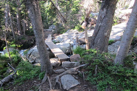
From the trail junction the trail follows along Vale Creek, The Loch's outlet stream. After .40 mile the trail climbs through switchbacks.
After four switchbacks the trail curves around obstacles to find the easiest passage and finally reaches The Loch at .80 mile from the Glacier Gorge Trail Junction.
The Loch is a worthy destination on it's own. It is 3.10 miles from Glacier Gorge Trailhead. There are great spots close to where the trail reaches the lake to take a break. The Loch is below treeline, but it is still a good idea to keep an eye on the weather.

To continue to Sky Pond, look for the trail to the right - going north around The Loch. Timberline Falls is visible in the above photo.
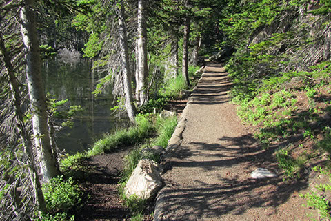
The trail around The Loch is easy to navigate. Trout are often times visible along the shoreline.
At the head of the lake, the trail follows near the feeder creek, Icy Brook.
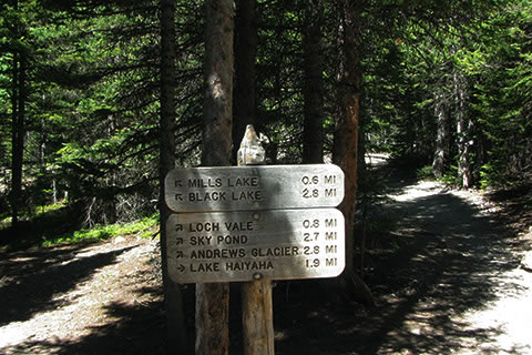
The trail climbs in spurts as it reaches Andrews Creek in .80 mile from the (Loch) sign when first reaching The Loch. The Andrews Creek Trail leads to Andrews Glacier. The footbridge is 3.90 miles from the Glacier Gorge Trailhead.
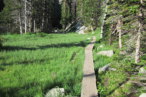
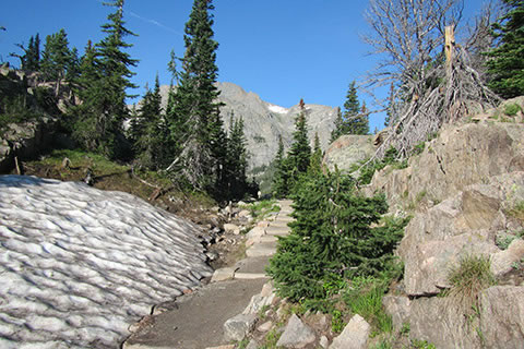
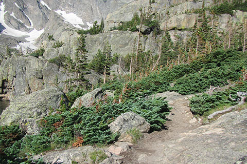
The trail gets even more scenic above the Andrews Creek Junction. Lush wetlands are crossed on boardwalks.
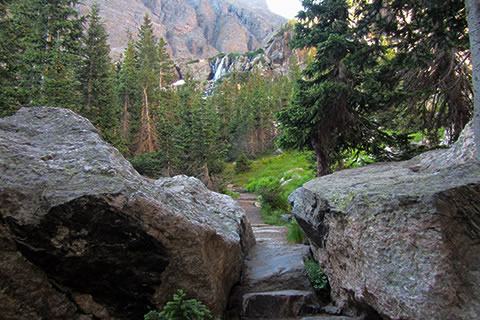
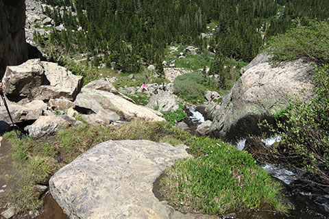
Then, Timberline Falls comes into view above the trees. The trail has seen substantial trail work.
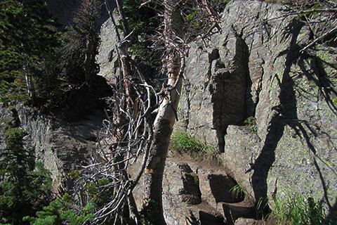
As the trail nears the falls, a cliff blocks the path. The trail climbs below the wall and angles toward Timberline Falls.
Please try to travel on the rocks avoiding the fragile alpine terrain.
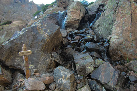
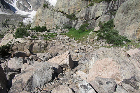
As the trail climbs, the paths degenerates into jumbled rocks. Though not uncommon in the mountains, many hikers do not like crossing the loose, wet, terrain. A sign gives direction to the jumble.
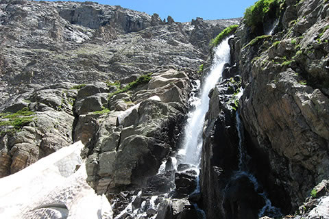
The trail does not go directly to Timberline Falls. It cuts off into a drainage a few feet before reaching the Falls. The drainage is often times very wet (snowy, or frozen).
Many hikers stop at the Timberline Falls. It is a destination.
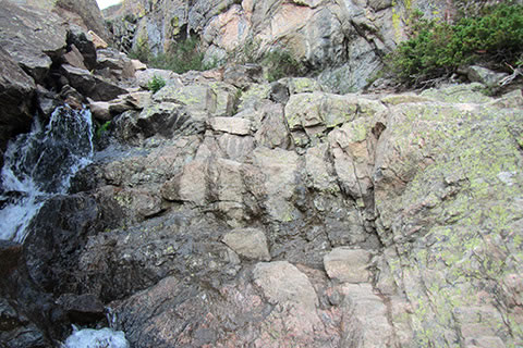
To continue, the trail scrambles up a weakness in the cliff. A drainage holds the key to passage. Follow the trail sign into the drainage. Scramble about 10 feet up a rock wall on the right side. It is not overly difficult, but the holds are not really positive.
Use care if you decide to attempt the scramble. Even though it is a scramble, it is the easiest route to Glass Lake. You will also have to down climb the scramble on your return.
Continue following the drainage a short distance. Generally hikers climb the right side of the gully. It may be difficult to remain dry.
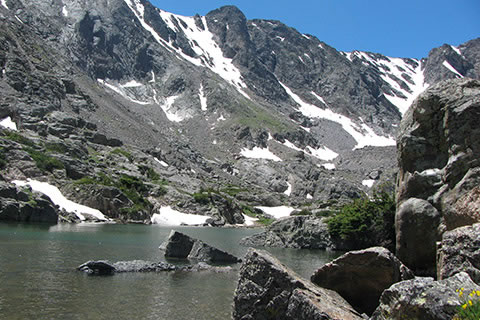
Glass Lake (or Lake of Glass) is very close to Timberline Falls. Glass Lake is .50 mile from the Andrew Creek Bridge and 4.40 miles from the Glacier Gorge Trailhead. To continue to Sky Pond there are more obstacles. A wall seems to block easy access to the right.
The easiest passage is to take a ramp to the right away from the lake and then cut back on top of the cliff that blocked the way.
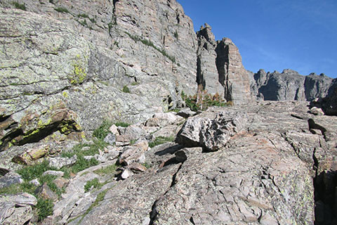
The trail weaves through rocks and the small stunted krummholz trees. There are many paths through this section, but I have found only one relatively easy one. The route is not clearly marked. Choose wisely. The trick is not to try and stay along the shoreline, instead climb a bit above the lake and gain a ledge that crosses a small cliff (that would have to be climbed if you had not gone right to avoid it) at about half height.
On gaining the ledge, follow it around the rock. The traverse is a bit airy, but not as difficult as scrambling up the route near Timberline Falls.
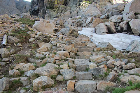
Keep a sharp eye for the improved path (stone work) as the path leaves Glass Lake and crosses to Sky Pond. It is easy to loose the path, but difficult to get lost. Continue to follow the drainage through the magnificent alpine cirque.
At .40 mile from first reaching Glass Lake, the route reaches Sky Pond. The lake is 4.80 miles from the Glacier Gorge Trailhead.