

Volunteer Trail
Date Hiked: 12/27/09
Park: Long Hunter State Park
Address: 2910 Hobson Pike, Hermitage, TN 37076-4027
Latitude: 36.10173, Longitude: -86.55374
Trail Rating: Easy
Round-Trip Mileage: about 11 miles
Other Trails in the Park: Couchville Lake, Bryant Grove, Day Loop Trail
For Map, Trail Mileage, GPS, and Trail Notes go to Page 2
Pre-Hike Comments
We hiked the Day Loop a few weeks earlier and were finally getting back to finish the North Long Hunter Trails. We are calling the North Trails, those that originate from Bakers Grove Trailhead.
We enjoyed the other trails in the Park and were hoping the Volunteer Trail would be as good as the others.
The Trail
Directions: From Nashville take I-24 east (about ten miles) to exit 62, Old Hickory Blvd (TN 171 N). The Park is reached in a little less than 7 miles. Along the way the Old Hickory changes names to Hobson Pike. Turn right with good signage (the first right after crossing Percy Priest Lake.) The Park Office is the first right.
The Park may also be reached from I-40 by taking the Mount Juliet exit (226) and heading south on Mt Juliet Road, continue straight eventually it becomes Hobson Pike.
From the Park Office to reach Bakers Grove Parking Area and Trailhead: travel .70 miles north (away from the lake) on Hobson Pike to Bakers Grove Road. Turn left on Bakers Grove, go a sort distance and turn left again at the "tee." The parking area is at the end of the road. All the turns are well signed.
Information on the Park is available at the Park Office. Water and restrooms are also available in the Office area. No facilites are available at the trailhead.
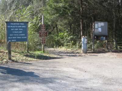
Bakers Grove Trailhead
Leaving the trailhead, hike down the old road for a tenth of a mile before turning right.
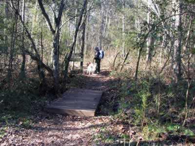
Turn right, cross small bridge to sign
Cross a small bridge and pass a sign indicating that you are hiking on the Day Loop Trail (and the Volunteer Trail.) The Day Loop Trail uses orange blazes and the Volunteer Trail uses white blazes. Both colors of blazes are used on this shared section of the trail.
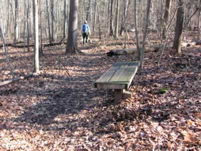
After climbing for a tenth of a mile to a small rise, a bench is available.
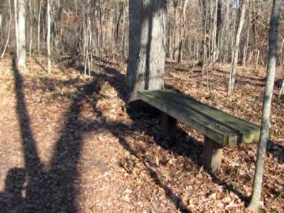
First bench at the top of a small rise
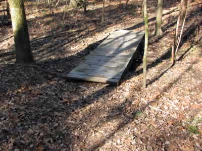
Continuing the trail crosses a bridge in another .15 miles. Just beyond the bridge the trail passes through a rock garden.
First bridge
At .55 miles from the trailhead the trail reaches a junction and a bench. The Volunteer Trail (white blazes) goes right and the Day Loop (orange blazes) is directed to the left. The .55 miles just completed will be repeated on the return.
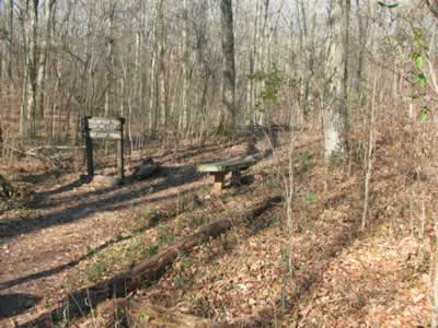
Junction, Volunteer Trail goes right
Go right at the junction, and follow signs for the Volunteer Trail. The trail stays to the right of a drainage as it gradually ascends. After a tenth of a mile the trail continues the climb, but it is steeper. Working through rock outcroppings, the trail joins a road near the top of the hill. A bench is reached .60 miles from the junction.
Bench at the top of the hill
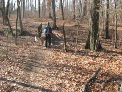
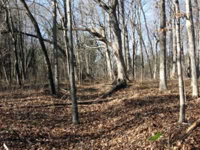
From the bench, it is a short distance to an old stone fence. From the fence it is downhill to the 2nd junction with the Day Loop Trail - 1.35 miles from the trailhead.
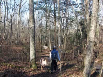
Descending to junction
Turn right at the junction and check for any pertinent information at the kiosk.
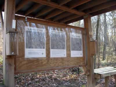
Kiosk, just past the junction
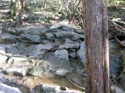
Just past the kiosk, the trail goes through a rock garden.
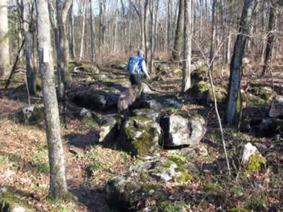
Rock garden
As the trail changes direction from heading north to heading west, an old dock(?) or structure can be seen in the cove at the water's edge.
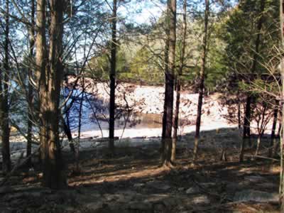
Remains of dock like structure
Heading west there were a couple of good views to the south. The trail generally follows the shoreline but the water is not readily accessible.
Another large rock garden is past, about .65 miles from the kiosk.
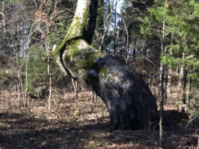
Odd tree
In .15 miles an unusual tree is on the right side of the trail. It comes out of the ground curving left, completes a ninety degree arc, and then shoots straight up to the sky.
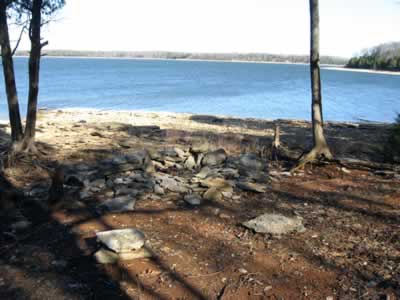
After passing the tree the trail continues close to the shore as it contours back north, then east, and then back west. It is .45 miles to a great shore access.
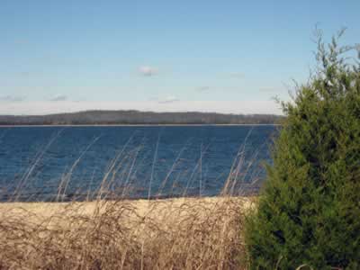
Shore view
This is the area where Old Hickory Blvd used to pass, before the lake.
There are a couple of unofficial campsites in this area. This is not the camping area. It is illegal to camp at any location other than the designated sites.
Illegal campsites
Continuing, the trail heads east, passing an old wire fence on the left in a few hundred feet. Once the cove is cleared the trail curves back to the north after .20 miles.
In .15 miles the trail passes through another rock garden.
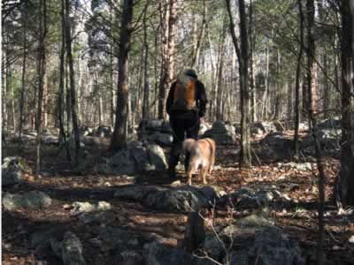
Heading to the point
The trail continues to the north as it heads toward a hardly distinguishable without a GPS point! At the point the trail curves around and heads in a southerly direction. The old Suggs Creek flowed from the east to west into the Stones River. It passes below the point.
In .10 miles an old road is crossed which probably went to the old Bannister Mine, now underwater.
Old road
A tenth of a mile further, an old twisted tree is near the trail.
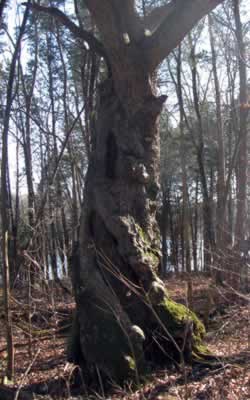
Twisted tree
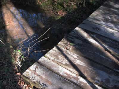
In .40 miles from the tree, the first of three bridges is passed. It is almost 4 miles from the trailhead.
Second bridge
In .60 miles the next small bridge is reached. A few places in this area the trail was harder to follow (in the fall.) Keep a sharp eye out for blazes or just continue to follow the shoreline.
Third bridge
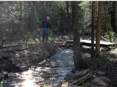
From the second bridge it is .70 miles to a creek or drainage crossing. Stones keep the crossing to a dry rock hop.
Creek crossing
Heading north, the last bridge is crossed in .15 miles.
Fourth bridge
Turning west, a mossy cedar forest is entered in .15 miles.
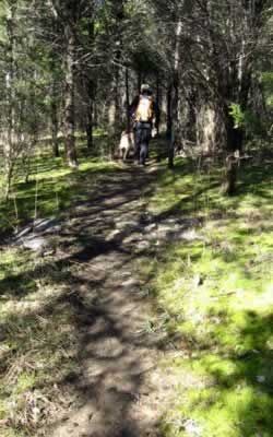
Mossy cedar forest
The campsites are just beyond.
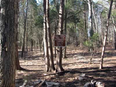
Camping area
The trail is 5.6 miles long - one way. The trail does not loop.