

Otter Creek Road
Date Hiked: 10/26/09
Park: Radnor Lake State Park and Natural Area
Latitude: 36.06243, Longitude: -86.80972
Trail Rating: Easy
Round-Trip Mileage: 2.5 miles, there and back
Other Trails in the Park: Ganier Ridge, Radnor Lake, South Cove, South Lake
For Map, Trail Mileage, GPS, and Trail Notes go to Page 2
Pre-Hike Comments
Radnor Lake is the quintessential State Park with well-groomed trails and exceptionally scenic views. I have hiked there many times over the years, but not frequently.
In general, the trails here are consistently in excellent condition and the facilities are first rate.
I am looking forward to the hikes.
The Path
The Otter Creek Road is included in the list of trails because it is so often walked by so many people - mainly those with dogs strollers. It is an enjoyable walk even if on a paved road. The road is also used to link Park trails for a longer walk.
Starting at the West Parking Area, Visitors Center and Trailhead, leave the map kisok and head up the road. After a gradual .15 miles climb, you are at the top of the hill and the south-west corner of the dam.
The road then follows the south shore of Radnor Lake to the east side. Watch out for the runners, power walkers, bicyclists, strollers, dogs, and anything else that might be pushed pulled or coerced into moving along the road. Birds and wildflowers are in adbundance on either side of Otter Creek Road. Take the time to pull out of the fast lane of the road and enjoy the observation decks overlooking the lake.
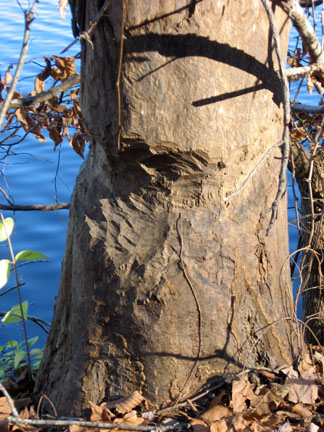
Beavers at work along Otter Creek Rd
After reaching the dam there is no more elevation gain on Otter Creek Road until beyond the lake.
Leaving the dam, the first (west) junction with the South Cove and South Lake Trails is on the right at .05 miles. These two great trails can be combined and walked as a loop.
From the junction, continue on the road for .25 miles to the first overlook. This is a great place for pictures.
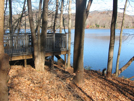
Overlooking the Lake
Another .20 miles leads to a second overlook. Opposite the second overlook is a small pond. You will also see steps on the right side that lead to the South Lake Trail.
Leaving the second overlook, it is .15 mile to the Hall Road and second (east) South Cove and South Lake Trails junctions. The trails go up the steps into the woods. The Hall Road branches to the right, leading to the Education Center.
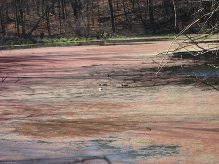
View of an inlet while crossing the Causeway
It is .15 miles across the Causeway to the junction with the Lake Trail.
Continue on the road .15 miles to the entrance of the East Parking Area and then .05 miles up the slight hill to the Trailhead restroom.
The distance from the west side restrooms to the east side restrooms is 1.15 miles. Turn around to return by Otter Creek Road to the West Parking Area or take one of the other trail options.
The road is rated as easy and is suitable for wheelchairs.