

Name of Trail, page 2
Trail Notes
The flood of May 2010 caused significant damage to the Otter Creek Road and other areas of the Park.
Otter Creek Road is closed to vehicular traffic.
The road is shaded.
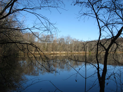
There are great views of the lake from the road.
There are also two viewing decks along the road.
Dogs are only allowed on the road. Many dogs take advantage of their park access and walk with their owners.
Strollers are allowed everywhere but they roll best on the road.
Runners and bicylces are also allowed on the road.
Otter Creek Road can be crowded. Plan your running and speed walking for a time with less congestion.
Otter Creek Road coupled with the Lake Trail is a great way to circumnavigate the lake.
Otter Creek Road Mileage
.00 West Parking Area Trailhead
.15 Radnor Lake Dam
.20 West junction with South Lake and South Cove trails
.45 1st overlook
.65 2nd overlook
.80 Hall Road and East junction with South Lake and South Cove trails
.95 Cross Causeway and junction with East Trailhead of the Lake Trail
1.10 Junction with access road to East Parking Area
1.15 East Parking Area Trailhead
Map Link
The link opens in a new window.
Radnor Lake Park Trails - pdf
GPS
Control Click or Right Click for download.
Radnor Lake Trails in Text Format - radnorLake.txt
Radnor Lake Trails in GPX Format - radnorLake.gpx
Radnor Lake Trails in KML Format - radnorLake.kml