

Henry Hollow Loop Trail
Date Hiked: 10/19/09
Park: Beaman Park - Nashville, TN
Latitude: 36.27335, Longitude: -86.90457
Trail Rating: Moderate
Round-Trip Mileage: 2 miles
Other Trails in the Park: Sedgehill (included w/ Henry Hollow Loop) and Ridgetop Trail
For Map, Trail Mileage, GPS, and Trail Notes go to Page 2
Pre-Hike Comments
See Ridgetop Trail
The Trail
After completing the Ridgetop Trail, we extended our hike by doing the Henry Hollow Trail. We enjoyed the Ridgetop Trail but it had more of a fitness walk feel than that of an outdoors experience. Henry Hollow Loop was a great hike in that it provided more variation in terms of elevation and scenary. We started the trail from the Highland Trailhead; but I will give the description beginning from the Creekside Trailhead.
Directions to Creekside Trailhead: see Ridgetop Trail. After turning off of Little Marrowbone Road into the Park, take the first left turn.
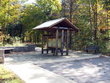
Creekside Trailhead
The Creekside Trailhead is an equal to great facility as the Highland Trailhead. In October 2009, there was also a portable restroom at the trailhead but no water (with today's budget cuts, I am sure the portable facility could also disappear). There are two picnic tables at the Creekside Trailhead.
Henry Creek Overlook
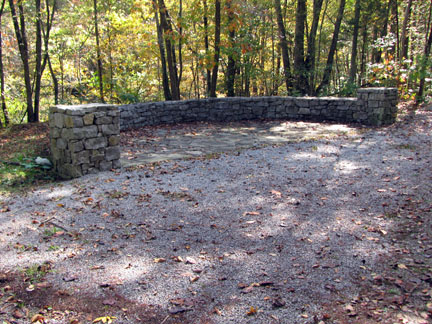
The Henry Hollow Loop Trail begins just beyond the trail kiosk. After walking a few hundred feet on flat terrain, there is a beautifully built stone overlook on the left. Shortly after the overlook is a trail junction. Going straight, the trail continues along Henry Creek, which is also called the Creekside Trail. To save perhaps the most scenic part of the trail for last (the Creek) go right at the junction and climb the hill to the Ridgetop Trail.
The two hundred foot climb is evenly graded over its .5 miles and the white blazes marking the trail are easy to follow. The Highland Trailhead parking lot becomes visible through the trees near the top of the climb long before the trail winds around to it. If you want to make a stop at the trailhead, please stay on the trail until reaching the trailhead spur.
At the Ridgetop Trail Junction, turn left to continue on the now combined Henry Hollow Loop/Ridgetop Trail, or turn right on the spur to the Highland Trailhead parking lot. Continue along the Ridgetop Trail for .3 miles more to a four-way intersection. Turn left to continue along the Henry Hollow trail. (The Shortcut Trail turns right and the Ridgetop Trail goes straight. If detouring to the Ridgetop Trail at this point, it is 1.85 miles to the turn around, 3.7 miles total). Note: The number of signs at the junctions can, at times, feel a bit overwhelming. Just follow the Henry Hollow Loop Trail signs.
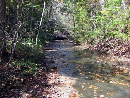
The trail winds back down the hollow for .7 miles to reach the creek. Two sharp switchbacks appear near the bottom but please do not shortcut, the trail will quickly wind its way back to the creek.
Henry Creek Bridge
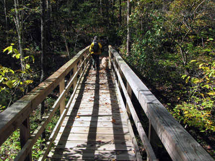
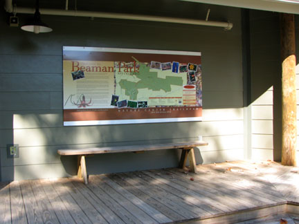
At the creek is another junction. To the right, the Sedgehill Trail crosses Henry Creek on a bridge and then climbs .6 miles to the Nature Center Trailhead. The climb gains about 200 feet of elevation, but the trail has an easy grade and benches are positioned at each switchback. Even though it is closed most of the time, the Nature Center is a beautiful, green facility. It is worth the walk up the hill just to see the building from the outside and to walk on the gangway out into the tree canopy.
Nature Center Trailhead
Back at the creek (Sedgehill/Henry Hollow Loop), continue straight along the Henry Hollow Loop. During this section, several good access points are available to Henry Creek. The slate bottomed creek bed makes a picturesque setting. It is .45 miles back to the Creekside Trailhead.
Henry Creek