

Hazard Cave Trail
Date Hiked: 03/17/11
Park: Pickett State Park
Address: 4605 Pickett Park Hwy (154), Jamestown, Tn, 38556, 931-879-5821
Trailhead Latitude: 36.54831, Longitude: -84.80348
Trail Rating: Moderate
Round-Trip Mileage: 1.70 miles
For Map, Trail Mileage, GPS, and Trail Notes go to Page 2
Pre-Hike Comments
We hiked Honey Creek Trail in Big South Fork the day before and were just planning on exploring Pickett Park. I had been to the Park many years ago but did not remember much about the trails.
The Trail
Directions: Take Highway 127 north from I-40 to Jamestown. Turn right at Hwy 154. It is about 12 (curvy) miles to the Park entrance. Turn left into the Park and follow the road past the CCC Museum and toward the Recreation Hall. Continue on the Park Road through the picnic areas and past Shelter No 2. The road curves around (U-turn) the Shelter. The trailhead is on the right. Parking is a short distance away down the hill.
The Trailhead
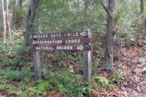
As the trail leaves the trailhead it passes a trail sign for Recreation Lodge - to the left. The trail to the Recreation Lodge is not a short cut, it is just a more scenic walk.
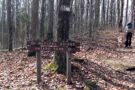
Trail sign at the first junction, go left for the Hazard Cave Trail
Continue straight and in .05 miles (about 250 feet) the trail reaches the first junction. To the left, the trail goes to Hazard Cave and the Natural Bridge Trail. To the right the trail also goes to Hazard Cave (the return path of the loop); but it also leads to the beginning of the Lakeview Trail and the Ridge Trail.
Turn left at the junction and climb the gentle hill.
Side trail to the Recreation Lodge - .20 miles
In .15 miles the trail junctions with a path going to the Recreation Lodge.
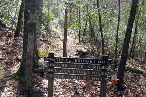
Side trail links with the Natural Bridge Trail - .35 miles
In another .15 miles the trail reaches another junction. The side trail leads to the Natural Bridge Trail.
Unofficial user trail, continue to the right
Continuing the trail stays on the crest of the ridge. Pass an unofficial (and unsigned) user trail.

Step from alternative trailhead - .70 miles
In .35 miles (.70 miles from the trailhead) a set of steps comes down from the left. The steps lead to Hwy 154 a short distance away. This is an alternative trailhead.
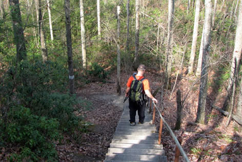
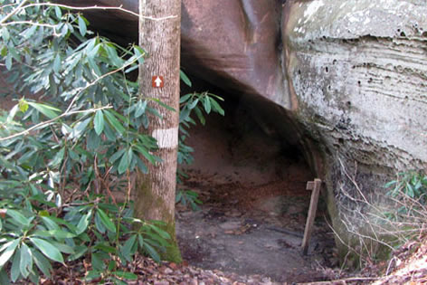
Steps to the trail - .75 miles
A few hundred feet beyond the side trail steps are another set of steep steps. Descend the steps and curve around to the beginning of the cliff which forms Hazard Cave.
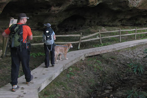
Boardwalk
A boardwalk leads along the cliff and under the overhang.
Sandy trail
The boardwalk ends and the trail follows a sandy path by a fence.
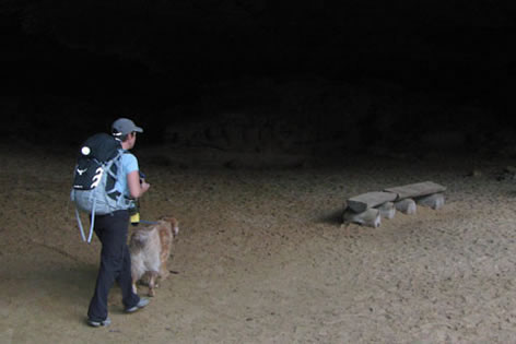
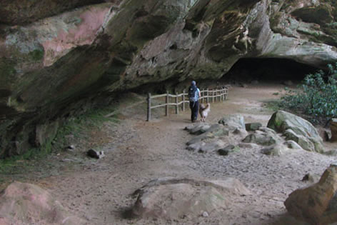
Hazard Cave - .90 miles
The bench beneath the large overhang is the official Hazard Cave area. It is located about .15 miles from the stairs on the trail.
Exiting the cave, looking back
Exit the cave at the far end, as the trail sneaks between the rock wall and a few trees.
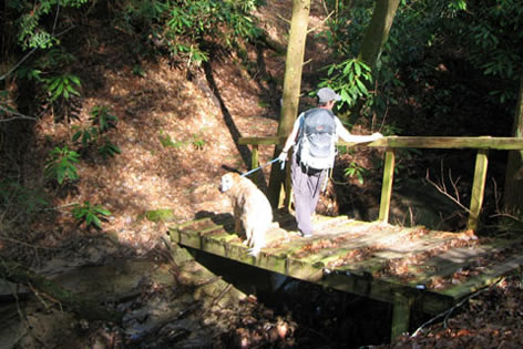
Slanted bridge - 1.20 miles
The trail then starts a gradual downhill in a drainage. After .30 miles cross the creek on a slanting bridge.
Narrow ledge along creek - 1.25 miles
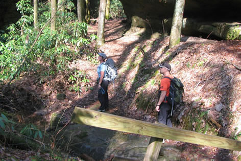
After a short distance, .05 miles, cross the drainage on a bridge and into a small canyon. Continue along a narrow creek bed ledge.
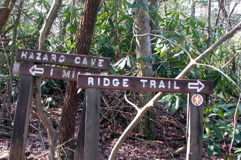
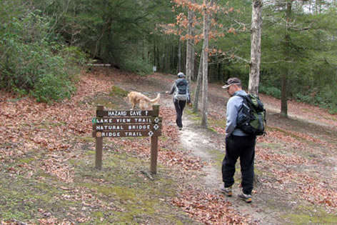
Trail junction with the Ridge Trail - 1.55 miles
Rise above the creek as the trail goes downhill for .30 miles to the junction with the Ridge Trail.
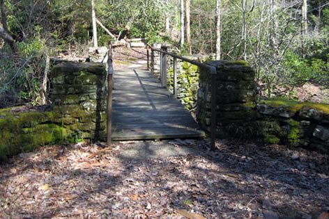
CCC bridge and Lakeview Trail - 1.60
Continue going straight (or bear right) and in .05 miles come to an old CCC bridge over Thompson Creek. The Lakeview Trail and the other leg of the Ridge Trail crosses the bridge.
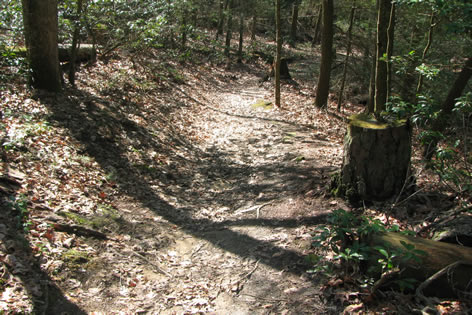
Trail returning to the trailhead
To finish Hazard Cave Trail turn right, away from the bridge, and climb a short hill for .05 miles to a junction. This was the first junction the trail reached after leaving the road. From the junction it is an easy few hundred feet to return to the trailhead.
Total distance was 1.70 miles