

Harpeth Woods Trail, page 2
Trail Notes
The Harpeth Woods Trail is located in Edwin Warner Park which is part of Warner Parks and the Davidson County, Nashville Metro Parks system.
The Nature Center is a great facility and well staffed.
The Nature Center was closed when we arrived, but the restrooms were open and water was accessible. Thanks!
There are no other easily accessible facilities near the Harpeth Woods Trail.
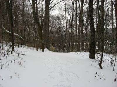
Directional signs on the trail
The trail is easy to follow and at a good grade.
Near the Nature Center there are a number of short distanced "nature trails" which may be confusing. Just follow the blue blazes.
The Park map rates the trail as moderate, however it is very similar in grade to the "hard" rated Ganier Ridge Trail of Radnor Lake.
The Park is dog friendly, but the dogs must be on leashes.
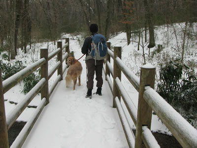
Jake on the high bridge close to the Nature Center
Runners are also allowed on the trails but they should yield to hikers.
The Old Roadway enters the Park off Hwy 100. At the bridge crossing Vaughn Creek there is a gate and parking for the Natchez Trace trailhead to the right. The same parking area is also used by the Woolwine Trailhead for the Harpeth River Greenway. There is no Woolwine Trailhead sign, kiosk, or information in the area or at the Natchez Trace Kiosk.
The old Natchez Trace is a section of the old road which leads from Natchez, Mississippi to Nashville.
We hiked the trail in a few inches of snow.
Harpeth Woods Trail Mileage
.00 to .05 Nature Center Trailhead kiosk to major trail junction
.05 to .15 Trail junction to Old Roadway (follow blue blazes)
.15 to .25 Old Roadway to the junction where Nature Loop (yellow blazes) branches off to the right
.25 to .45 From junction to the saddle between two knobs
.45 to .80 The saddle to the Old Roadway at the junction of the road to Ridgefield and the Little Harpeth River
.80 to 1.10 Old Roadway to Owl Hollow Trailhead
1.10 to 1.15 Owl Hollow Trailhead to Owl Hollow trail (goes right)
1.15 to 1.35 Owl Hollow Trail to road crossing
1.35 to 1.45 Road crossing to Quarry Trail
1.45 to 1.50 Quarry Trail to rejoining of Quarry Trail following the bypass route
1.50 to 1.75 2nd Quarry Trail to Old Natchez Trace
1.75 to 1.95 Junction with the Old Natchez Trace to the bridge crossing Vaughn Creek
1.95 to 2.05 Bridge to Natchez Trace Trailhead
2.05 to 2.30 Natchez Trace Trailhead to junction with the Nature Loop Trail (at the bridge)
2.30 to 2.45 Nature Loop Junction to major trail junction near the Nature Center
2.45 to 2.50 Old Natchez Trace to Nature Center Trailhead Kiosk
Note: The trail is a loop.
Map Link
The link opens in a new window.
Edwin Warner Park - pdf
Warner Parks Trails (large map) - pdf
GPS
Control Click or Right Click for download.
Note: The Edwin Warner - Harpeth Woods Trail (blue) and the "closed to vehicles", Old Roadways are included in the file.
Edwin Warner Park in Text Format - edWarner.txt
Edwin Warner Park in GPX Format - edWarner.gpx
Edwin Warner Park in KML Format - edWarner.kml