

Day Loop Trail, page 2
Trail Notes
Bakers Grove Trailhead and Parking Area was well maintained and we saw two Ranger vehicles patrolling. Perhaps we looked suspicious!
We met several people walking the Day Loop Trail. Several more must have been either doing the overnight trail, or we just missed them on the loop.
There were a few dogs being walked, all were on leashes.
There were no facilities at the trailhead. Restrooms and water are availible at the Park Office.
Benches were placed along the trail.
In the fall/winter there were some great views of the lake.
The hike was very diverse with lots to see.
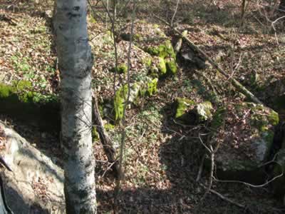
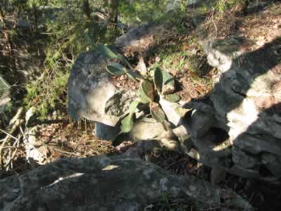
We were by the moss and limestone.
The hike was easy, with no steep grades. I have run the trail before and the footing can be difficult when wet.
The Loop Trail is a good hike.
Loop Trail Mileage
.00 to .10 Trailhead to right turn.
.10 to .20 Cross small bridge, pass a directional sign and continue to the first bench.
.20 to .35 From the bench to bridge crossing drainage.
.35 to .55 Bridge through rock garden and to junction of Volunteer and Day Loop trails.
.55 to .65 Turning left (as the sign indicates) to bench.
.65 to 1.10 Bench to rock garden with sink holes on both sides of the trail.
1.10 to 1.25 Rock garden to bench by the shore.
1.25 to 1.90 Bench by the shore to small bluff.
1.90 to 2.35 Bluff to bench.
2.35 to 2.45 Bench to ravine - drainage.
2.45 to 2.65 Ravine to the second junction with the Volunteer Trail. The Volunteer Trail goes left to the kiosk and on to the campsites. The Day Loop Trail continues straight.
2.65 to 2.75 Junction to old stone fence - trail climbs.
2.75 tp 2.85 Stone fence to bench.
2.85 to 3.15 From bench trail crosses the top of the hill and descends to a rock outcroppings where the trail descends even steeper.
3.15 to 3.45 Steep descent to first junction of the two trails. (The rest of the trail is a repeat of the first .55 miles of the trail.)
3.45 to 3.65 Junction to bridge.
3.65 to 3.80 Bridge to bench.
3.80 to 3.90 Bench to left turn.
3.90 to 4.00 Turn to trailhead.
Map Link
The link opens in a new window.
Long Hunter Park Trails, North - pdf
GPS
Control Click or Right Click for download.
Note: All the Long Hunter trails are included in the file. No need to download more than once.
Long Hunter Park Trails in Text Format - loHuntTL.txt
Long Hunter Park Trails in GPX Format - loHuntTL.gpx
Long Hunter Park Trails in KML Format - loHuntTL.kml