

Cumberland Plateau, Byrd Creek, and Overnight Trails, page 2
Trail Notes
The Cumberland Plateau Trail is a great short hike.
There were numbered stops on the trail, but I do not know if the Park has a corresponding nature trail brochure.
There is no parking at the trailhead by the dam. If you park at the Office, you have to walk down the road .15 miles to the start of the trail. On the Cumberland Plateau Trail, you would also have to return to your vehicle after finishing the loop.
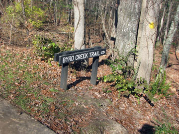
The Byrd Creek Trail begins after one leg of the Cumberland Plateau Trail ends.
As an Eagle Scout project a great bridge was built over a small creek, one mile from the trailhead.
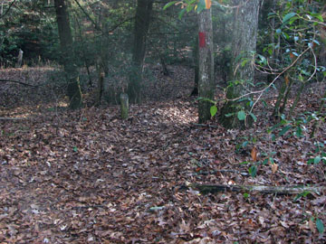
The Byrd Creek Trail would be shaded year round.
Byrd Creek Trail ends at the Office.
The Overnight Trail starts 1.05 miles from the trailhead, 1.25 miles from the parking at the Park Office.
With rolling hills, the terrain stays varied on the Overnight Trail, but not too difficult.
On the Park Map, the Overnight Campsite is not in the correct location.
The first bridge over Three Mile Creek was hit by a tree. Use care trying to cross the bridge or look for a crossing.
It did not seem as if many hikers use the Overnight Trail.
The trails may be walked in either direction.
The Park’s facilities were well maintained.
Water and restrooms are available at the restaurant or the Office.
There is a great CCC display in the Park Office (11/22/09).
The trails were well marked and signed. They were easy to follow.
Cumberland Plateau Trail Mileage
.00 to .15 Office Parking to the start of the trail
.15 to .55 The first leg of the trail following the lower leg, down the stairs by the dam.
.55 to 1.00 Returning on the other leg back to the trailhead by the dam.
1.00 to 1.15 Return to the Office Parking
Byrd Creek Trail Mileage
.00 to .15 Office Parking to the start of the trail
.15 to .55 The first leg of the trail following the lower leg, down the stairs by the dam.
.55 to 1.20 From the start of the yellow blazes to the Boy Scout Bridge
1.20 to 1.25 The Bridge to the start of the Overnight Trail - turn right to continue on the Byrd Creek Trail.
1.25 to 1.40 A short link to the junction at the end of the blue blaze, Overnight Trail.
1.40 to 1.80 From the junction to creek crossing
1.80 to 2.70 Creek to Office Parking
Overnight Trail Mileage
.00 to .15 Office Parking to the start of the trail
.15 to .55 The first leg of the trail following the lower leg, down the stairs by the dam.
.55 to 1.20 From the start of the yellow blazes to the Boy Scout Bridge
1.20 to 1.25 The Bridge to the start of the Overnight Trail - follow the blue blazes to the left.
1.25 to 2.90 The start of the Overnight to the creek crossing
2.90 to 3.15 Creek to the designated overnight camping area
3.15 to 3.80 Camping are to the turnaround, turn right
3.80 to 4.65 Follow the crest of the ridge
4.65 to 4.95 Descend to Three Mile Creek
4.95 to 6.50 Creek to the suspension bridge
6.50 to 7.15 Bridge to junction with Byrd Creek Trail (yellow)
7.15 to 7.55 From the junction to creek crossing
7.55 to 8.45 Creek to Office Parking
Map Link
The link opens in a new window.
Cumberland Mountain Park Trails - pdf
GPS
Control Click or Right Click for download.
Cumberland Mountain Park Trails in Text Format - cumbMtnTrails.txt
Cumberland Mountain Park Trails in GPX Format - cumbMtnTrails.gpx
Cumberland Mountain Park Trails in KML Format - cumbMtnTrails.kml