

Bells Bend Loop Trail
Date Hiked: 10/11/09
Park: Bells Bend, Nashville Metro Park
Address: 4187 Old Hickory Blvd. Nashville, TN 37218
Latitude: 36.15606, Longitude: -86.92631
Trail Rating: Easy
Round-Trip Mileage: 2.5 m (from Poplar Hollow TH)
For Map, Trail Mileage, GPS, and Trail Notes go to Page 2
Pre-Hike Comments
Bells Bend Park was opened in 2007. The land was orginally purchased by the City to use as a fill site, but later was found to be inappropriate for the intended use. As bottom land along the Cumberland River, the soil was rich with archeological artifacts and teeming with bird life. The land needed to be protected as a park or natural area.
Mayor Purcell gave the land to the Metro Parks and Bells Bend Park was created. We had heard good reports of the Park from friends; but we had never visited Bells Bend. We were anxious to hike the Loop Trail.
The Trail
Bells Bend Park is located in Davidson County (Nashville), but feels as if it is much further away. Isolated at the tip of Bells Bend, the park would be very close to West Nashville if the old ferry still crossed the river. As it is, it takes approximately thirty minutes from mid town Nashville to the park.
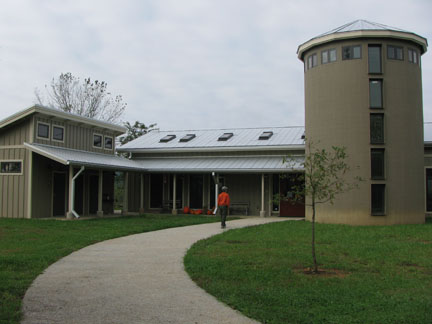
Outdoor Center
The basic instructions to find the Park are: leave Briley Pwky at exit 24, Ashland City Hwy. Go west 2.8 miles toward Ashland City. At Old Hickory Blvd, go south (left), there is a light at the intersection and a huge convenience market on the right. Follow the road 4.2 miles to the park, located on the right. The entrances are clearly marked with large signs. The Outdoor Center is the second entrance.
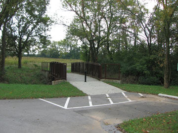
Bridge at Poplar Hollow Trailhead
You may start the Loop Trail from either the Outdoor Center or from the Poplar Hollow Trailhead. The Outdoor Center has very limited hours, so if you want to visit the facility it must be during the prescribed times. There are restrooms and water available only if the facility is open.
From the first junction looking left at the Outdoor Center, we turned right and went toward the river first.
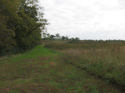
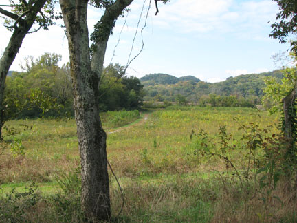
Basically, the Loop trail gives an overall tour of the park. From the Poplar Hollow Trailhead, cross the creek on a bridge and continue .10 miles to a trail junction. Turn right. The trail is a wide, mowed path through the fields of the old farm. There are no trail markers or directional signs. A few mower cuts of old farm roads cross the path, but the Loop Trail continues straight.
From the junction it is .10 mile to the group campground and .40 miles to a farm road crossing the path. Continue hiking straight, it is .10 miles to the Cumberland River.
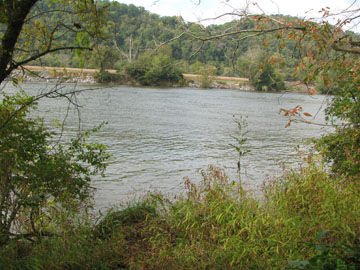
Cumberland River
Following the river, the path continues for more than half of a mile. There are paths of access as well as viewing points along the trail. Birds love the trees along the banks of the river.
Leaving the river, the trail goes slightly uphill to a junction in a little more than .10 miles. When first looking at the intersection it seems as if the trail goes right. On closer inspection it is the farm road that goes right, the trail continues up a gentle hill, past a shrub row, and then to the left.
The trail comes up the hill from the river and continues across the farm road located below the trees in the foreground.
After the odd intersection, the path continues up the small hill to a crest at about a hundred feet above the river banks. A farm road junction at .25 miles and a nice row of trees cross the path at the top of the hill in .10 miles further.
Looking uphill to the Outdoor Center.
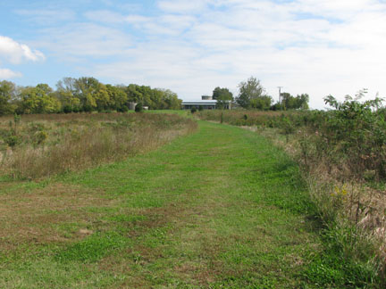
From the tree row, continue straight along the mowed path as it follows the rolling contour of the land. At .10 miles a farm road goes left and curves over to the barn. Continue hiking .35 miles to another junction and the Outdoor Center can be seen uphill and off to the right; the old barn is downhill to the left. The Loop Trail continues straight.
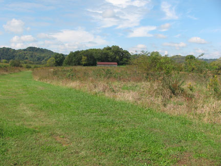
From the same location as the one above, downhill toward the barn.
The trail then curves left and follows the Poplar Hollow Creek .20 miles until it reaches the junction with the trailhead access trail. Turn right and re-cross the bridge to access the trailhead in .10 miles. Continue straight if you just want to go for another loop!
The trail is rated easy. It is a very pleasant hike.