

Rainbow Falls Trail - Mt Le Conte - page 2
Mountain Notes
The trailhead parking was empty when I arrived; but was filled when I returned.
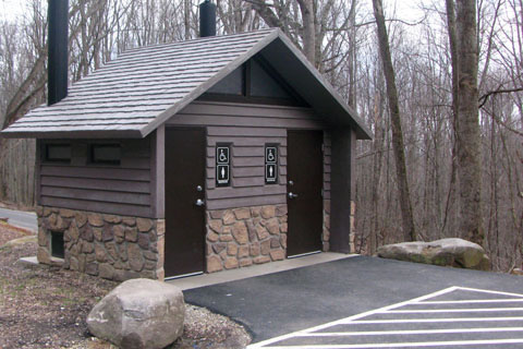
Restroom are at the trailhead, there is no water.
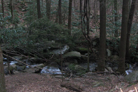
You can filter or purify water from the creek. The trail stays relatively close to the creek for almost 3.5 miles.
An overflow lot is available a bit further up the road.
The trail to Rainbow Falls was really worn. It is a popular hike.
I have seen comments that suggested the trail was very rocky, I did not notice it.
The trail was very easy to follow and was never really steep. It is easier but longer than Alum Cave Trail.
Making the map, I named by description a few waypoints, which by using the pictures on page 1, the waypoints should be recognizable. There were many undistinguishable curves along the trail. It is pointless to use a waypoint that is indescribable.
Short side trips to Rocky Spur, the Lodge, Cliff Tops, and High Top (summit) are all good excursions.
Water is available at the Mount Le Conte Lodge, but only during warmer weather. There is also a spring located near the Lodge off the Trillium Gap Trail. Water is also available along the Alum Cave Trail. All the water from the spring or along the trail would need to be treated, filtered, or both.
Check with Mount Le Conte Lodge for services, prices, and the dates of the operating season.
Please respect the Lodge - the workers, guests, and the facilities.
My one way mileage to the summit was 6.80 miles (GPS).
Mileage note: Without surveying, it is difficult to find accurate mileage. That being said, we try hard to be as accurate as possible. The NPS signs indicate the Rainbow Falls Trail to the Bullhead Trail Junction is 6.0 miles. Our mileage was only 5.95. I could have added .05 miles to a segment, but didn't. If you are using a GPS, your mileage should be similar. Remember during the summer months with the full leaf canopy, the GPS signal is not as accurate as in the winter months. The summer data usually measures short.
The summit is a stack of rocks (a cairn).
The trail continuing past High Top (the summit) is the Boulevard. The trail traverses a ridge for 5 miles to join the Appalachian Trail 2.7 miles from Newfound Gap.
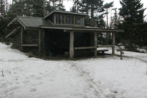
There was some litter on the trail and a lot of litter at the shelter.
At the shelter there was a stack of firewood and a recent fire ring, even though a sign designating "No Fires".
To descend, reverse the Rainbow Falls Trail or try the Bull Head Trail. Bull Head is only a half mile longer and returns to the same trailhead.
Rainbow Falls Trail Mileage, one way
0.00 Rainbow Falls Trailhead
1.90 Lower creek crossing, bridge
2.80 Rainbow Falls, bridge
3.30 Upper crossing
3.85 Rocky Spur Ridge
4.85 Switchback
5.35 Rocky Spur Trail sign
5.95 Junction with the Bull Head Trail
6.35 Junction with the Alum Cave Trail
The Lodge is between the Alum Cave and Trillium Gap Trails.
6.45 Junction with Trillium Gap Trail
6.80 High Top, the summit!
Map Link
The link opens in a new window.
New - Mount Le Conte Map - pdf
GPS
Control Click or Right Click for download.
Rainbow Falls in Text Format - rainbowFallsLeConte.txt
Rainbow Falls in GPX Format - rainbowFallsLeConte.gpx
Rainbow Falls in KML Format - rainbowFallsLeConte.kml