

Tonahutu Creek Trail -
Rocky Mountain National Park, page 2
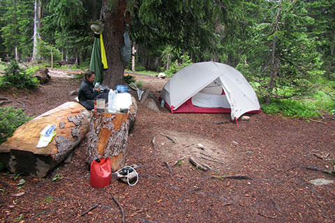
Haynach Campsite
Route Notes
The Tonahutu Creek Trailhead is easy to access. It is very close to the town of Grand Lake. There are motels, restaurants, groceries, and even an outdoor gear store (Never Summer Mountain Products) available in town.
There were lots of no parking signs at the actual Tonahutu Creek Trailhead. No real cause for alarm though, the North Inlet Trailhead is at the end of the road (663) which is just a short distance away. There is parking at the North Inlet Trailhead.
North Inlet Trailhead also has nice privies!
Since you pass the Tonahutu Creek Trailhead on the way to parking at the North Inlet Trailhead, it is feasible to drop off gear (with someone) at Tonahutu Creek Trailhead, park at North Inlet, and walk back to the trailhead sans pack. Of course if, you are concerned about walking that short of distance, perhaps you need to look at the pack once more and leave the iron skillet behind!
For hiking the entire Loop the best trailheads are North Inlet or Kawuneeche Visitor Center.
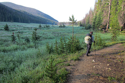
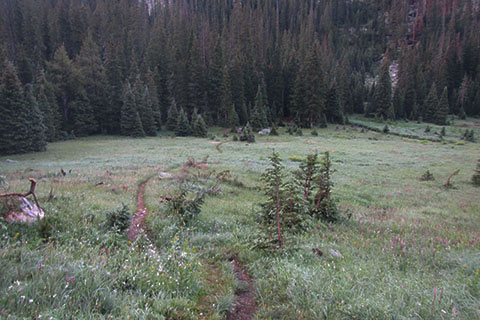
Southern section of Big Meadow from the Tonahutu Trail
If you are just hiking up the Tonahutu drainage, there are more options for starting points. Hikers could start from the Kawuneeche Visitor Center, Green Mountain Trailhead, Onahu Creek Trailhead, or the Tonahutu Creek Trailhead. Using the Green Mountain Trailhead makes the shortest routes to Big Meadow, Granite Falls, and the upper Tonahutu drainage.
We parked and started at the KVC - Kawuneeche Visitor Center for hiking the North Inlet Trail and the Loop. We reasoned that the extra hiking distance from the KVC to North Inlet Trailhead was minor when compared to the peace of mind from parking in a somewhat secure area. We had not heard of parking issues at North Inlet, we just assumed the KVC would be safer.
North Inlet, Tonahutu Creek, and Kawuneeche Visitor Center trailheads are all outside of the Park's fee area.
The trails in the Park do not use (painted) blazes. There are however, directional signs at each junction. The Tonahutu Creek Trail is easy to follow.
The Haynach Lake Trail is unmaintained. The trail to the campsites is easy to follow, but above the campsites, there were a couple of places, where we stopped and scratched our heads for a few seconds before determining the correct route. The main problems were caused by downed trees.
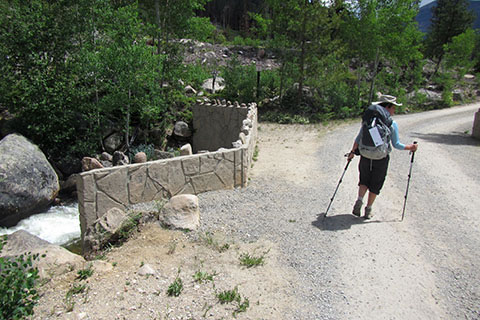
The road bridge crossing Tonahutu Creek
between Tonahutu Creek Trailhead and North Inlet Trailhead
Starting from the Tonahutu Creek Trailhead, after a short climb near the start, the trail is wide and climbs at a steady, easy grade.
The Tonahutu Creek Trail sees a lot of horse traffic, especially the first mile or so. The trail is therefore very sandy.
The Kawuneeche Visitor Center is .65 mile off the Tonahutu Creek Trail. An emergency phone is located at the Visitor Center.
Overnight permits are required for backcountry camping in the Park. The permits are available at the Kawuneeche Visitor Center, but popular sites seem to be reserved long before the summer season.
Harbison Ditch, just looks like a creek. Water is diverted from Tonahutu Creek to form the ditch.
The first 4.25 miles to the Green Mountain Trail Junction (at Big Meadow) is not overly interesting. It is however, a nice, relatively easy, stroll through the woods. Many hikers bypass this section by starting at Green Mountain Trailhead. It is 1.80 miles from Green Mtn Trailhead to the junction with the Tonahutu Creek Trail.
Big Meadow is really big.
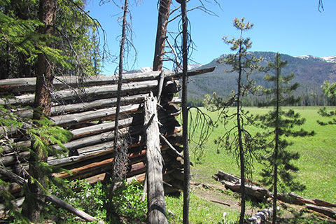
There are two cabin ruins just off the trail. Be careful investigating the cabins. They are ruins - meaning they are no longer structurally sound.
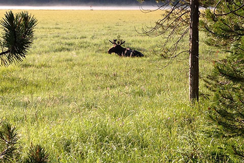
We saw moose laying in the tall grass of the meadow.
At the Onahu Creek Trail Junction, the Tonahutu Creek Trail changes direction from a northward path to an eastward one, as the trail climbs toward the Continental Divide.
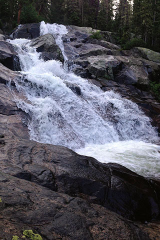
Granite Falls is a popular destination.
Above Granite Falls the Tonahutu Wildfire was impressive. It was amazing that the fire fighters were able to contain the fire. When the fire occurred ('13) we had reservations for hiking the Loop from Bear Lake (east side of the Park). We really wanted to do the Loop and tried to find ways around the blaze. When we saw the burn, we realized that there really was no way around the blaze.
Side Trail to Tonahutu Meadow Campsites
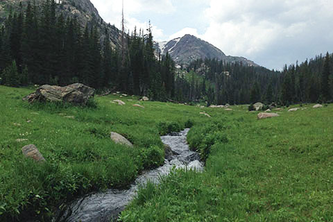
At Tonahutu Meadow, the burn ends. the Meadow is a large grass land, but not nearly as big as Big Meadow.
The Haynach Lake Trail is significantly more difficult than any section of the Tonahutu Creek Trail. In fact it was more difficult than any part of the Loop.
As the trail to Haynach Lakes becomes smaller and smaller, the adventure becomes larger and larger.
We camped at the Haynach campsites. The sites are close to a stream and a marshy meadow. We did not see any moose, but it looked as if they should live there.
We could not find any sources with matching mileages for trail distances.
Some of the mileages we use on cloudhiking might also be slightly wrong. We try to be as accurate as possible. We hike the trails and notice when things are not right.
The 0.25 mile red dots on the trail track line gives the hiker a scale on all parts of the trail. It is easy to calculate a rough estimate of the distance to any location on the trail. It is also comforting to know that the scale is the same throughout the map. In other words 0.25 mile at one point on the map is .25 mile at all other points of the map!
For the first time on the Loop Map, we started adding green arrows and a distance (green) to signify the distance between a red dot and the end of the section. For example, if the green distance between the final red dot and red star (indicating a waypoint and the end of the segment) was a fraction of the quarter of a mile segment, the green distance would give the determined distance.
Note: red dots on the trail track line are reset at each trail junction.
For Mountain Data and Route Guide
go to Page
1
Tonahutu Creek Trail Mileage
0.00 Tonahutu Creek Trailhead
0.85 Kawuneeche Visitor Center Spur
4.25 Green Mountain Trail - Big Meadows area
4.85 Onahu Trail Junction
7.60 Granite Falls
9.35 Junction with Haynach Campsites side trail
Haynach Lake Trail - unmaintained
10.85 Haynach Lake
Map Link
The link opens in a new window.
RMNP - west - The Loop - North Inlet, Tonahutu Creek , and other Trails - pdf
RMNP - west - The Loop - North Inlet, Tonahutu Creek , and other Trails - geospatial pdf