

Pikes Peak
Climb Notes
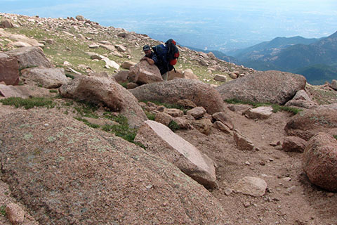
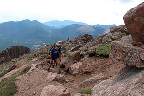
The Barr Trail is a Class 1 trail. It is essentially a hike, but a long one with lots of elevation to gain. An ascent of Pikes Peak is not to be taken lightly.
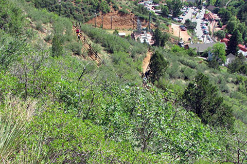
In '09 the City of Manitou Springs began a fee based parking system. We were there on the day they were installing the meter. It seems that the parking is better for Barr Trail hikers, who are going to Barr Camp or spending the whole day on the mountain, but maybe not as good for the Incliners (those hiking or running the Incline). Incline users are not even supposed to use the parking area, which makes finding a parking space much easier.
We have climbed Pikes Peak twice from car to car and once with staying two nights at Barr Camp. On our first trip, a car to car hike in September, we left at day break, had cooler weather and no storms. The second trip was in the summer, another car to car trip in which we left very early in the morning (2 ish) and were still caught in a late morning thunderstorm. We had already summited and were descending below treeline before the storm hit. On the third trip we left the trailhead in the midday, afterall we were only going to Barr Camp. It was very hot over the first four miles. Hiking the first section of the trail, in the heat of the day, was the hardest part of the entire climb. We strongly advise picking a cool time of the day for those hot, exposed slopes. Walking in the dark using headlamps is not a bad choice.
Oh, those initial slopes were also very hot when we were descending them in the afternoon.
Bring a water filter or purifyer. There are creeks and runoffs, but you need a means of making the water safe to drink.
Pikes Peak is a mountain and has mountainous weather. Storms are likely each afternoon of the summer, but can happen at anytime.
The weather will probably be hot at the trailhead and cool on the summit. In between you have to adjust layers to stay comfortable and dry.
Keep track of the time and your speed as you walk. Know when you are going to arrive at the summit.
If the weather looks threatening, it is time to turn around.
The services at the top of the Peak are not open all year nor are they open all night. If you are hiking the Peak you need to be self-sufficient and prepared for the extremes.
Read the Warning Sign carefully at the trailhead.
Hiking the Barr Trail from car to car or breaking the trail up with a night or two at Barr Camp are unique experiences.
To climb Pikes Peak safely, you must carry the essentials, but you must also somehow limit the weight of your pack to a manageable load.
Train before you begin your attempt. There are easier mountains out there to climb. Even Pikes Peak from the Crags Campground is much easier than the Barr Trail (car to car).
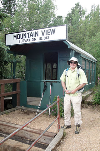
There are options to shorten the hike by using the Cog Railway. It is possible to ride to Mountain View and start your hike from there (1.5 miles to Barr Camp), or hike the Peak and ride the Cog down, or ride the Cog up and hike down.
Some folks we met at Barr Camp were planning on carrying all their overnight gear (even with tents) to the summit. The hike is tough enough without carrying extra weight. Plan wisely.
While staying at Barr Camp, we left for the summit at the first crack of dawn and ate a doughnut for breakfast at the Summit House. Breakfast came with our overnight stay in the shelter, but we started a couple of hours before it was served.
We stayed two night at Barr Camp. On the second morning we ate the pancakes. They were great. The hosts make good food and company.
Save enough for the trip down the mountain. Some folks think it is harder than the climb.
Please practice minimum impact traveling - climbing - hiking.
Link to our Summer 2011 hike
For Mountain Data and Route Guide
go to Page
1
Barr Trail Mileage
| Mile | Interval | Location |
|---|---|---|
| 0.00 | 0.00 | Manitou Springs Trailhead |
| 0.50 | 0.50 | Spur Trail - Junction |
| 1.60 | 1.10 | Incline Access |
| 2.80 | 1.20 | Passageway (under arch) |
| 3.00 | 0.20 | Top of Incline - Junction |
| 3.15 | 0.15 | No Name Creek |
| 4.70 | 1.55 | 7.8 m Sign |
| 5.50 | 0.80 | Lightning Point |
| 5.90 | 0.40 | Mountain View Trail - Junction |
| 6.50 | 0.60 | Barr Camp |
| 7.50 | 1.00 | Bottomless Pit Trail - Junction |
| 8.50 | 1.00 | Boulder Switchback |
| 9.00 | 0.50 | Timberline A-Frame |
| 9.40 | 0.40 | Roberts Memorial |
| 10.20 | 0.80 | NE Ridge Switchback (2m) |
| 11.15 | 0.95 | Cirque Overlook |
| 11.75 | 0.60 | Golden Stairs |
| 12.00 | 0.25 | Barr Plaque |
| 12.15 | 0.15 | Summit Trail Sign |
Total Round Trip Distance - 24.30 miles
Map Link
The link opens in a new window.
Pikes Peak - Barr Trail - pdf
note: The mileage on this historic trail was difficult to determine. All of my sources seemed to disagree. We had four GPS tracks and were finally happy when the mileages mostly agreed with the Marathon mileages from the skyrunner.com site. We know their mileages are correct. If you are interested in running the Peak, you must visit their site.
For more info on Pikes, visit 14ers.com
GPS
Control Click or Right Click for download.
Barr Trail in Text Format - barrTr.txt
Barr Trail in GPX Format - barrTr.gpx
Barr Trail in KML Format - barrTr.kml