

North Inlet Trail - Rocky Mountain National Park - page 2
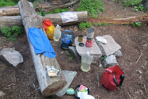
Ptarmigan Campsite
Route Notes
The trailhead is easy to access. It is very close to the town of Grand Lake. There are motels, restaurants, groceries, and even an outdoor gear store (Never Summer Mountain Products) available in town.
The North Inlet Trail may also be reached by starting at the Onahu Creek, Green Mountain, or the KVC Spur trailheads.
We parked and started at the KVC - Kawuneeche Visitor Center. We reasoned that the extra hiking distance from the KVC to North Inlet Trailhead was minor when compared to the peace of mind from parking in a somewhat secure area. We had not heard of parking issues at North Inlet, we just assumed the KVC would be safer.
North Inlet Trailhead has nice privies.
We took a photo of a visitor at the North Inlet Trailhead with a dog (on the first page). Dogs are not allowed on the trails within the Park.
The trails in the Park do not use (painted) blazes. There are however, directional signs at each junction. The North Inlet Trail is easy to follow.
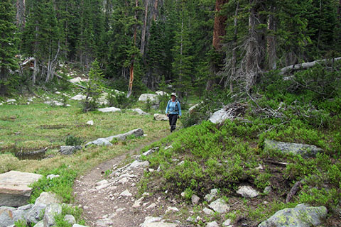
Hiker on the cool morning trail
Life in the mountains is best when you start early in the mornings. On our first hike we drove from the east side of the Park and did not start our hike until 11 or so. The trail through Summerland was unpleasantly warm and we had to dodge afternoon storms further up the trail.
On our second trip, we stayed in Grand Lake and started on the trail before 8. It was a pleasant stroll to North Inlet Junction.
The trail follows the North Inlet stream. Water is close at hand but needs treating.
North Inlet Trail has moderate horse traffic.
The trail is popular. Expect to see many other hikers.
We met a number of hikers who started at Bear Lake, hiked to Flattop and then down the North Inlet Trail to Grand Lake, as a day hike. A pre-arranged, fee based, shuttle transported the hikers back to the east side of the park.
All of the campsites seemed good. We even stayed a night at the Ptarmigan campsite. It did not seem to be well used, but still was a nice site.
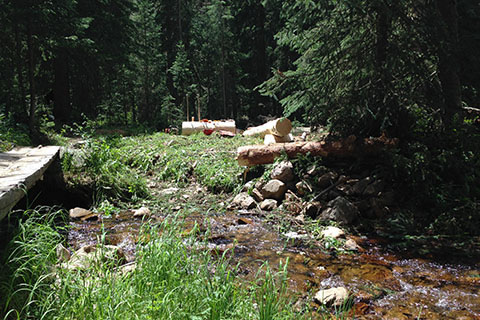
Logs hewn and prepared for a bridge
Oddly enough we noticed that many of the footbridges were damaged on our '14 hike. A trail crew was out repairing and replacing the timbers.
We viewed War Dance Falls when it was big (lots of water). It was the most spectacular falls along the North Inlet Trail. There wasn't a trail that led to the falls and downed trees blocked progress, still, the view of the falls was worth the effort.
To reach North Inlet Junction required a bit more effort for the climb through the switchbacks, but the steeper sections were relatively short.
Continue on the North Inlet Trail a short distance to reach the North Inlet Junction campsites.
The climb to Lake Nokoni and Lake Nanita are at good grades.
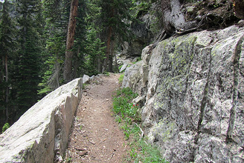
Rock cut on the Lake Nanita Trail
The trail to Lake Nokoni is wide and well used. It seems that far fewer hikers venture over the saddle to Lake Nanita.
Camping is not allowed at Nokoni or Nanita.
We call the two lakes: No-Na.
Ptarmigan Mountain is a good scramble (class 2) from Lake Nokoni. There are a few glimpses of trail along the route, but most of the traveling is cross-country over loose rocks. It is not overly pleasant and you are accustomed to traveling over similar terrain.
Lightning is a danger in the mountains. Plan and move responsibily to avoid storms.
The steep east faces of the Ptarmigan Towers are technical climbing adventures.
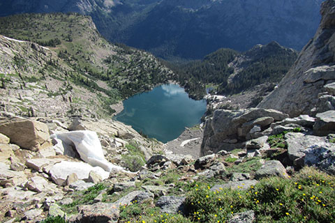
Lake Nokoni from near the summit of Ptarmigan
We could not find any sources with matching mileages for trail distances. For example, when we compared the mileage from the Park signs and the trailhead kiosk maps - often times the mileages disagree and some mileages are just wrong (the trailhead kiosk map indicates that it is 1.3 miles from North Inlet Junction to Lake Nokoni - it is really 2.3 miles.)
Some of the mileages we use on cloudhiking might also be slightly wrong. We try to be as accurate as possible. We hike the trails and notice when things are not right.
The 0.25 mile red dots on the trail track line gives the hiker a scale on all parts of the trail. It is easy to calculate a rough estimate of the distance to any location on the trail. It is also comforting to know that the scale is the same throughout the map. In other words 0.25 mile at one point on the map is .25 mile at all other points of the map!
For the first time on the Loop Map, we started adding green arrows and a distance (green) to signify the distance between a red dot and the end of the section. For example, if the green distance between the final red dot and red star (indicating a waypoint and the end of the segment) was a fraction of the quarter of a mile segment, the green distance would give the determined distance.
Note: red dots on the trail track line are reset at each trail junction.
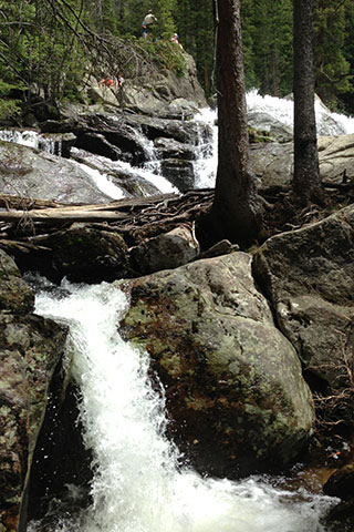
Cascade Falls
For Mountain Data and Route Guide
go to Page
1
North Inlet Trail Mileage
mile
0.00 North Inlet Trailhead
1.20 Summerland Park
3.50 Cascade Falls
4.80 Big Pool
6.75 Ptarmigan Creek (sign at creek)
7.50 North Inlet Junction
Lake Nanita Trail
9.80 Lake Nokoni
10.90 Lake Nanita
Map Link
The link opens in a new window.
RMNP - west - The Loop - North Inlet, Tonahutu Creek , and other Trails - pdf
RMNP - west - The Loop - North Inlet, Tonahutu Creek , and other Trails - geospatial pdf