

Laurance S Rockefeller Preserve and Phelps Lake Trails
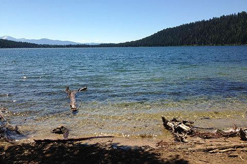
Looking south from near the inlet stream
Route Notes
Rockefeller donated the 1,000 plus acres of his land to Grand Teton National Park. The land became the LSR Preserve.

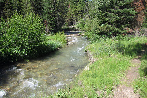
Outlet Stream - Lake Creek
The Interpretive Center alone is worth a visit.
The area is different than other sections of the Park. It adheres to higher standards.
Parking is limited and there is no additional parking allowed. Park personel (or volunteers) are stationed in the parking area and manage the parking.

Restroom near Phelps Lake
The restrooms are all self composting, and in general green buildings and facilities.
There are no trash recepticles anywhere. If you brought it with you, you are expected to take it away with you also.

Horses move off the Phelps Lake Trail into Wister Draw
Horses are not allowed on the trails - even though, I assume, that horses were historically used on the land while it was a homestead, guest ranch, and personal vacation land.
There is no camping on the land and no overnight parking on the property.
The facilities and trails are first rate.
The trails are rated easy to moderate in difficulty. The LSR - Phelps Lake - Loop would be rated as easy, except for the distance.
The trail crosses the busy Moose-Wilson Road twice.
The Connector Trail allows for some creative linking of trails.
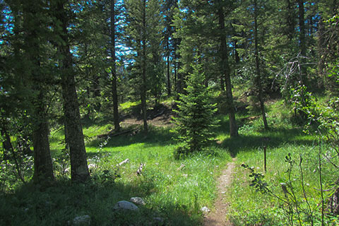
Trail beside Aspen Ridge Trail
The Aspen Ridge and Boulder Ridge Trails do not see the traffic of the other trails. When we walked them, we saw two hikers on one trail and only one other hiker on the other. The hikers seemed surprised to see us.
It would be a good loop to hike Aspen Ridge and Boulder Ridge trails and return to the trailhead.
Use the map to make other loops.
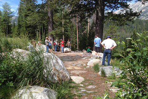
Crowds at the view point
The Phelps Lake view point (where the Lake Creek Trail intersects the Phelps Lake Trail) is just a special place.
Huckleberry Point is almost the same view as the Phelps Lake view point, but a bit more rugged.
After crossing the inlet stream, the trail goes down close to the shore and gives a great view from the water's edge to the south. (The photo at the top of the page from this point.)
The boulder on the eastern shore of the lake has an outstanding view up Death Canyon. It was actually our favorite.
Boulder Ridge Trail
Please practice minimum impact usage at all times. Think before you step.
For Mountain Data and Route Guide
go to Page
1
For Route Guide of Other Trails in the Preserve
go to Other Trails
LSR - Phelps Lake Loop Trail Mileage
0.00 LSR Intrepretive Center
0.10 Lake Creek - Woodland Jct
0.60 Road Crossing
0.70 Aspen Ridge Tr Jct
1.50 Phelps Lake
2.10 Huckleberry Pt Jct
3.05 Valley Trail Jct
3.50 Valley/Death Canyon Tr Jct
5.30 Boulder Ridge Jct (north)
5.40 Woodland Trail Jct
5.80 Boulder Ridge Jct (south)
6.15 Road Crossing
6.40 Lake Creek - Woodland Jct
6.50 LSR Intrepretive Center
Map Link
The link opens in a new window.
LSR - Phelps Lake Trails - pdf
LSR - Phelps Lake Trails - geo-pdf