

Grays Peak - Torreys Peak
Climb Notes
Grays Peak Trailhead is an excellent facility. The road to the trailhead is often only passable by a high clearance four wheel drive vehicle or one that the driver does not mind scraping a bit.
Make sure you bring toilet paper and sanitizing wipes for the overused privies.
There is no treated water at the trailhead.
A large creek is very close to the trailhead but we always brought water from town - caution: this was once a heavily mined area.
The parking area fills very early.
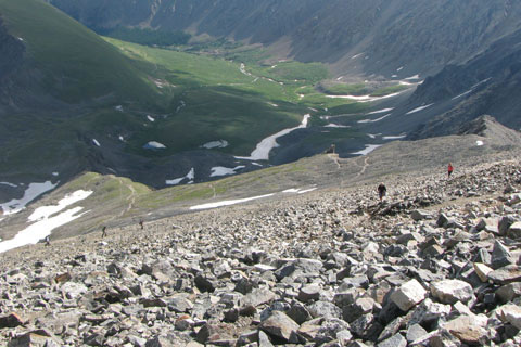
The North Slopes Route of Grays Peak is a trail. In good weather the route is a Class 1 hike.
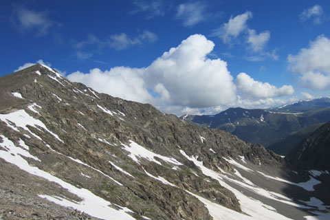
The South Slopes of Torreys is a bit harder than Grays but still does not qualify for a raise in grade. The South Slopes of Torreys is a Class 1 also.
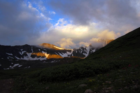
Despite both routes' Class 1 gradings, the trails or paths are still steep and the climbs still go over 14000 feet.
The peaks are very popular with the Front Range crowds. On weekends it can be very congested on the road, the parking area, the trails, and on the summits.
After climbing above the willows it is hard to find a place to relieve yourself in private, unless you start very early in the morning.
It is not much harder to climb both peaks than it is to just climb one.
We enjoyed the view from the summit of Torreys. We could see all the way down Stevens Gulch to the Interstate.
Even though relatively easy, the peaks are still mountains. Be sure to show them respect. Train before attempting the climbs, carry the ten (plus) essentials, dress appropriately, watch the weather, and get an alpine start.
Kelso Mountain is an interesting alternative peak. Staying on the ridge, it is a hard Class 2; but the moves can be bypassed on the right side of the ridge.
Kelso Ridge of Torreys is a Class 3. It is not a hike. Most of the route stays on top of the ridge or to the right. Some even say the ridge has Class 4 moves. There are definitely areas along the ridge where you would get hurt if you fell.
Please practice minimum impact traveling - climbing - hiking.
For Mountain Data and Route Guide
go to Page
1
Grays - Torreys Trail Mileage
Grays Peak Trail Mileage - North Slopes Route
0.00 Trailhead in Stevens Gulch
0.80 Switchback beneath Kelso Mountain
1.50 Large Trail Sign
1.85 Junction with Kelso Saddle Trail
2.80 Junction with Torreys Trail - South Slope
3.75 Grays Peak Summit
Total Round-Trip Distance 7.50 miles
Torreys Peak Trail Mileage - South Slopes Route
0.00 Trailhead in Stevens Gulch
0.80 Switchback beneath Kelso Mountain
1.50 Large Trail Sign
1.85 Junction with Kelso Saddle Trail
2.80 Junction with Torreys Trail - South Slope
3.25 Grays - Torreys Saddle
3.70 Torreys Peak Summit
Total Round-Trip Distance 7.40 miles
Grays-Torreys Trail Mileage - Combo
0.00 Trailhead in Stevens Gulch
0.80 Switchback beneath Kelso Mountain
1.50 Large Trail Sign
1.85 Junction with Kelso Saddle Trail
2.80 Junction with Torreys Trail - South Slope
3.75 Grays Peak Summit
4.15 Grays - Torreys Saddle
4.60 Torreys Summit
3.70 miles to return to the trailhead - See Torreys Peak Mileage - in reverse
Total Distance 8.30 miles
Map Link
The link opens in a new window.
Grays Peak - Torreys Peak - pdf
Note: For more info on the peaks, visit 14ers.com
GPS
Control Click or Right Click for download.
Grays-Torreys in Text Format - grays-torreys.txt
Grays-Torreys in GPX Format - grays-torreys.gpx
Grays-Torreys in KML Format - grays-torreys.kml