

Estes Cone, page 2
Climb Notes
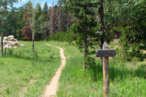
The trail is unblazed, but is still easy to follow. The path is well worn to Storm Pass. From Storm Pass cairns (rock piles) must be followed to the summit.
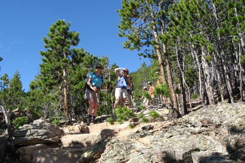
For a seasoned, fit hiker, the Storm Pass Trail is rated as moderate and the Estes Cone Trail is rated as difficult.
For those not acclimated or fit, the trail will be a challenge.
The 3 mile trail from Lily Lake to Storm Pass only climbs 1,200 feet. The trail from Storm Pass to the summit of Estes Cone climbs 800 feet in .75 miles.
Any mountain is more difficult in inclement weather.
Carry the essentials (ten or more) and understand that your safety is your responsibility.
There are no restrooms on the hike.
The only reliable water sources are low on the trail. The water would still need to be treated.
The Estes Cone hike leads to an exposed summit, the views from the top are amazing.
Pets are not allowed on the trail.
Hikers should stay on the trail to avoid further impact to the area.
For Mountain Data and Route Guide
go to Page
1
Estes Cone Mileage
.00 Storm Pass Trailhead at Lily Lake
.25 Storm Pass trail leaves road
.45 Sharp left turn
.65 Bridge over Aspen Brook
1.20 Switchback
2.25 Boulder
3.05 Storm Pass
3.25 Second switchback above the pass
3.50 Upper slopes
3.65 Summit Ridge
3.75 Summit
Map Link
The link opens in a new window.
Twin Sisters, Estes Cone, and Lily Lake - pdf
GPS
Control Click or Right Click for download.
Estes Cone & Lily Lake in Text Format - lilyLakeTh.txt
Estes Cone & Lily Lake in GPX Format - lilyLakeTh.gpx
Estes Cone & Lily Lake in KML Format - lilyLakeTh.kml