

Angels Landing
The Adventure Guide to Angels Landing includes a trail description, photographs of the trail, comments from our hikes, mileage data for the trail, the Angels Landing topo map, and Angels Landing GPS track logs. The guide will familiarize you with the mountain and help you on your climb.
Mountain Data
Date Climbed: 11Jun12
Elevation: 5,790'
Range: Zion National Park
Latitude: 37.25942, Longitude: -112.94995
Route: West Rim Trail and Angels Landing
One-Way Mileage: 2.5, from trailhead to the summit of Angels Landing (Scouts Lookout is 2.0 miles)
For Map, Trail Mileage, GPS, and Trail Notes go to Page 2
Pre-Climb Comments
The Angels Landing route in Zion National Park is famous. On our short visit to the Park, Angels Landing was our pick route. The route was supposed to have scrambling, exposure, and a near perfect position.
The Climb
Directions: Springdale, UT has a unique relationship with Zion National Park. The small tourist town is bordered on three sides by the Park. Check with Google (or other direction engines - GPS, Bing, etc; or even a hard map) for directions to Springdale. In the months of April through October, the Zion Canyon Scenic Drive is closed to traffic (without special permission). A free tram/bus system is in place to transport hikers, climbers, canyoneers, and sightseers to the Canyon's destinations. Park at the Visitor's Center and ride the tram to The Grotto picnic area/trailhead. Water and restrooms are available at the trailhead. The West Rim/Angels Landing Trails start at the Grotto.
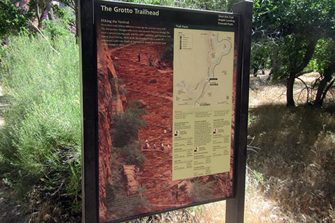
From the bus stop, cross the road to a bridge across the Virgin River. Stop and read the signage before continuing.
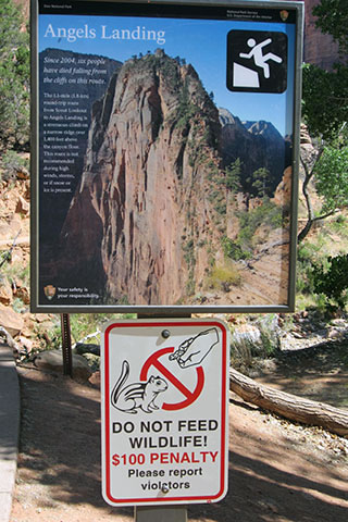
A few warnings reflect the dangers of the trail. Angels Landing is a serious route.
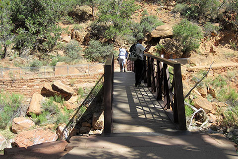
Cross the bridge to the trail on the other side. The Virgin River is the main drainage of the canyon. It is also the river through the famous Narrows section of the canyon.
On the other side of the bridge a junction in the trail splits hikers going to the Upper Emerald Pools and Angels Landing.
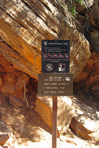
At the junction, the sign indicates the mileage and directions for the trails.
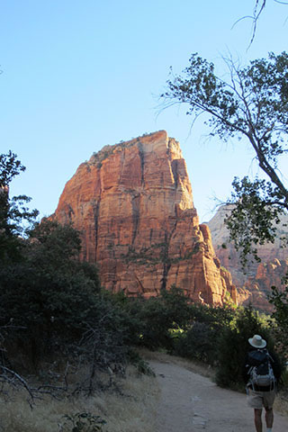
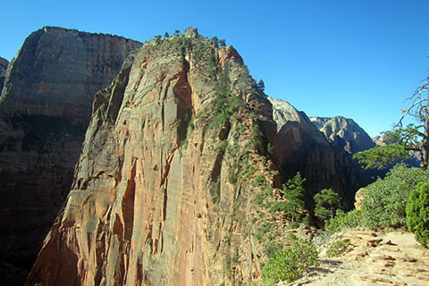
Leave the mileage sign and follow the easy trail toward the peak. Angels Landing commands the view.
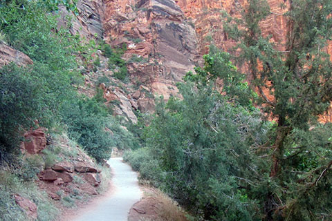
The path remains at an easy grade as it approaches the lower cliffs blocking the entrance to Refrigerator Canyon. The path is paved!
After leaving the river, the trail begins to climb. On nearing the canyon walls the trail begins a series of switchbacks. Though the switchbacks are wiggly, this is not Walter's Wiggles. The switchbacks help tame the steepness of the climb.
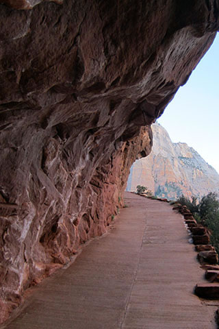
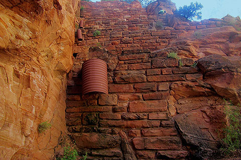
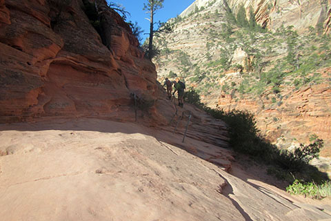
A short section of the trail as it traverses to Refrigerator Canyon is cut into an overhang.
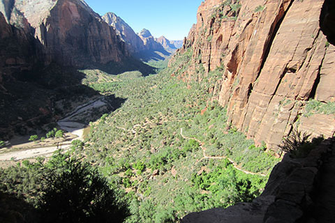
Views of the canyon and the lower trail.
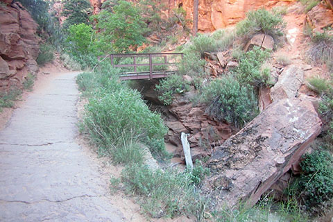
A bridge crosses the drainage as the trail enters Refrigerator Canyon. When we hiked the trail in June the creek bed was dry.
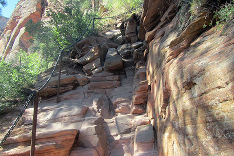
The trail climbs gradually up the canyon following the drainage. Along the trail are many interesting rock formations, holes, and overhangs.
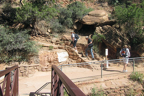
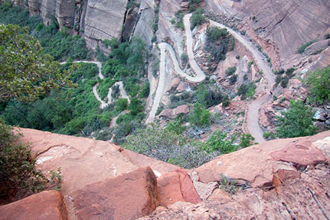
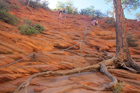
At the north end of the canyon the trail climbs through a few switchbacks and then finally comes to a landmark of trail design. The section is known as Walter's Wiggles. Each wiggle is a short switchback.
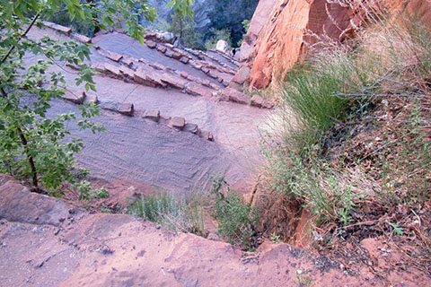
Looking down the 21 wiggles.
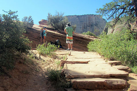
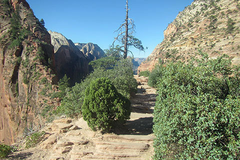
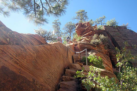
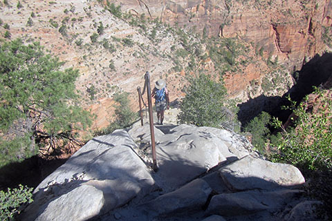
At Scouts Lookout, 2 miles from the trailhead, the Angels Landing route leaves the West Rim Trail (West Rim Trail continues to the north). There are excellent views of Zion Canyon from the Lookout.
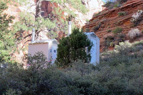
Privies are located at Scouts Landing. The rooms see a lot of use! The privies are visible from the summit of Angels Landing.
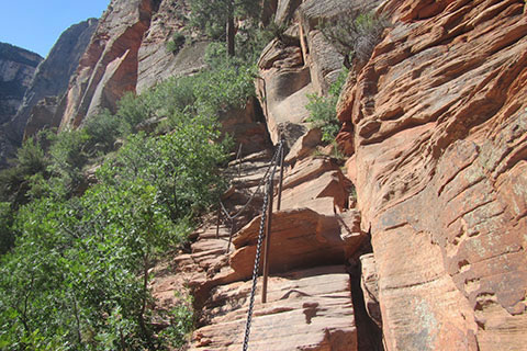
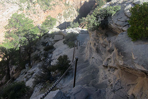
From Scouts Lookout head south across a slab toward chains and stanchions located on the right (west) side of the ridge.
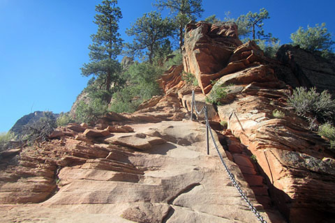
A slab is the first climb. The chains aid the climb and show the easiest route.
At the top of the slab, cross over to the east side of the knob and follow the path toward a gap between the first knob and the main ridge.
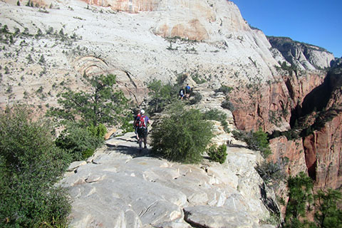
As the path narrows the views increase.
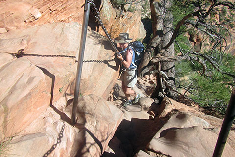
Climb down to the small saddle and cross the exposed path guarded with the chain.
Now, the climbing begins ... climb up the corner and then move left.
Follow the chains staying to the left of the ridge.
The path squeezes behind a tree.
Climb through a steeper slope.
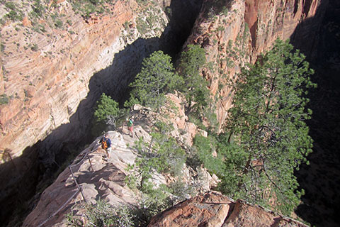
The route stays below the crest of the ridge, but climbs steadily.
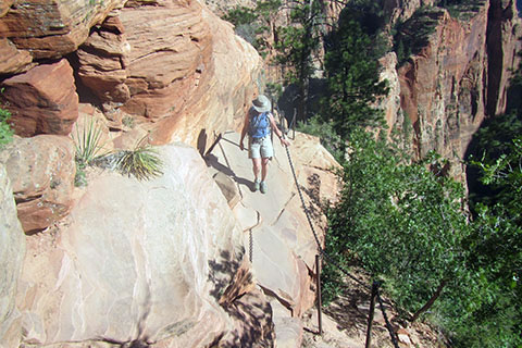
A good series of ledges connect the climbs.
Climb to the ridge. The route goes to the dark rock high on the crest. (Picture was taken on the descent.)
An overview of the ridge, taken from the dark rock lookout mentioned above.
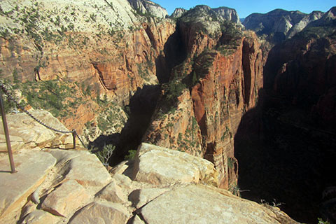
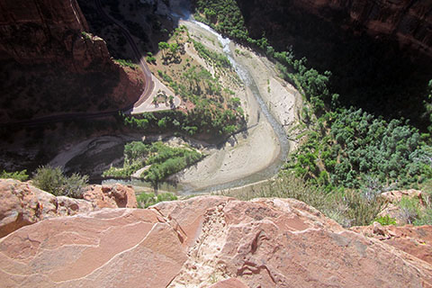
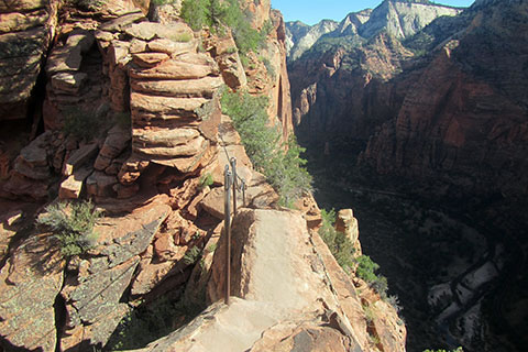
The upper part of the ridge is exposed. Looking to the far ridge, the privies at Scouts Lookout are visible.
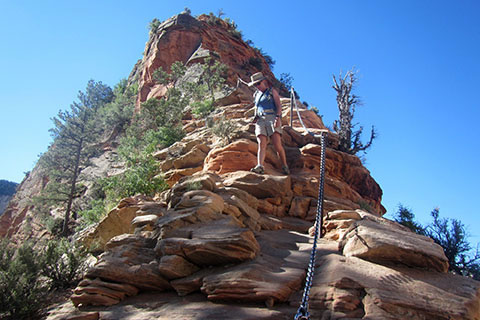
Climbing near the crest of the ridge.
On the west side of the ridge just below the summit ridge.
The summit is a long almost level finger.
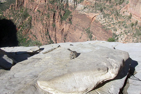
A chipmunk on the summit.
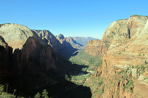
The view to the south from Angels Landing. The summit is 2.5 miles from the trailhead. Reverse the route to return to the trailhead.