

Stones River Greenway - Kohls to Percy Priest Dam
Date Hiked: 6/12/10
Greenway: Stones River Greenway
Address:
Percy Priest Dam, 3734 Bell Road, 37214
Kohl's Trailhead, 2330 Jackson Downs Bvd, 37214
Percy Priest Dam Trailhead
Latitude: 36.15866, Longitude: -86.62094
Kohl's Trailhead
Latitude: 36.18538, Longitude: -86.63432
One Way Mileage: 2.95 Miles
Other Trails in the Park: Stones River Greenway - Skate Park to Kohls
For Map, Trail Mileage, GPS, and Trail Notes go to Page 2
Pre-Trip Comments
The Kohls Store Trailhead to Percy Priest Dam section of the Stones River Greenway links the Lake to Donelson and on to East Nashville and Downtown. This great path is a continuation of the linear greenway.
The Path
Directions: Percy Priest Dam Trailhead, take Interstate 40 to exit 219 - Stewart's Ferry Pike, go south on Stewart's Ferry (follow signs) to Percy Priest. Take the first left south of the Interstate - Bell Road or Blackwood (sorry, but Bell Road is straight and to the left at this point - Blackwood is the road to the right at the intersection.) Continue to follow the signs. Take the first left off Bell Road - before crossing the dam. The trailhead is at the end of the road.
The Kohls Trailhead is located at 2330 Jackson Downs Boulevard, Hermitage, TN. Jackson Downs is off Lebanon Road at the Target Shopping Center. The trailhead is in the parking area near the Stones River.
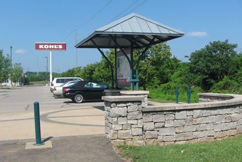
Kohls Trailhead - 0.0 miles
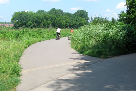
From the Kohls Trailhead the paved path follows along beside Stones River, going away from the bridge.
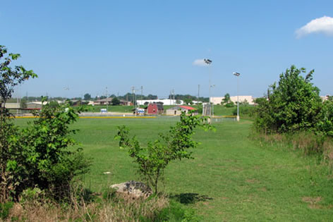
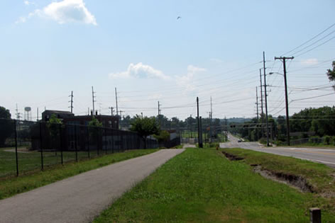
Ballfields behind the Target - 0.30 miles
Heading upstream the path goes behind the shopping center. Fields are visible at .30 miles.
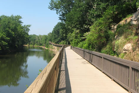
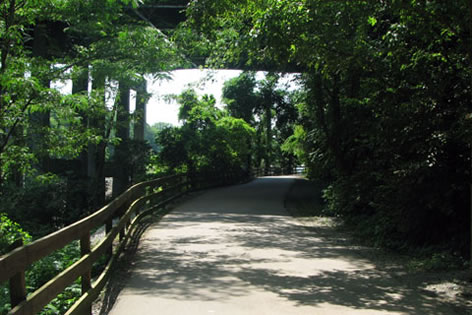
Beginning the raised walkway - 0.65 miles
The raised walkway (boardwalk) begins in .35 miles beyond the fields.
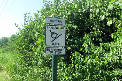
Start of the climb to the railroad - 1.0 miles
The path begin a steady climb. A sign indicates that it is steep.
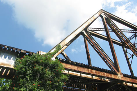
Looking back at the Railroad Bridge - 1.40 miles
Going under the train tracks the path descends.
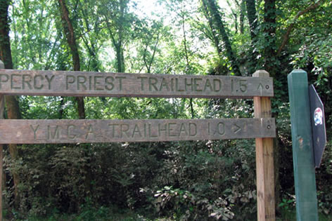
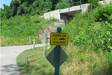
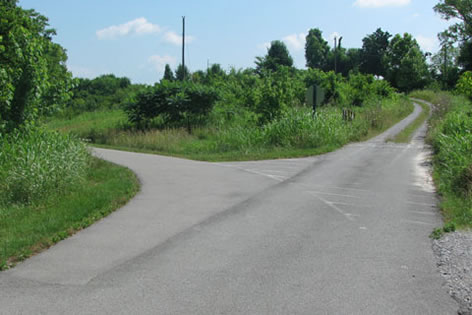
Junction - 1.50 miles
A junction is reached 1.5 miles from the trailhead.
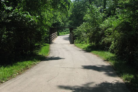
Bridge just beyond the junction
The Stones River Greenway continues straight.
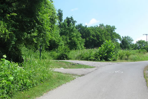
The split closest to I-40, going from the Dam to Kohls - 2.15 miles
There is a split in the path in .45 miles. The path reunites in .20 miles.
A minor turnoff to the right is the access to the Stewart's Ferry Apartments area .30 miles from the split.
Going under the I-40 Bridge - 2.80 miles
Continuing the path goes under the Interstate 40 bridge in .35 miles.
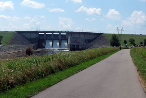
Percy Priest Dam and Trailhead - 2.95 miles
Percy Priest Dam is visible once clear of the bridge. The trailhead is .15 miles away.
Stones River and Stewart's Ferry Connector
Path joins road - 0.50 miles from Stones River - Y Junction
From the junction at mile 1.50 turn right. The path climbs gently to a road at .50 miles. At the junction the path goes right and under the second railroad bridge.
Just beyond the RR Bridge take the first left for the Stewart's Ferry Connector keeping straight leads to the YMCA
Just beyond the bridge are two turns, the first left turn is the Stewarts Ferry Connector Path.
Looking along Stewart's Ferry from the end of the Connector - 1.05 miles from Stones River - Y Junction
The path follows close to the railroad track and terminates at Stewart's Ferry Pike across from Blue Brick Road in .55 miles.
Stones River to the Donelson YMCA
From the junction at mile 1.50 turn right. The path climbs gently to a road at .50 miles. Turn right and go under the railroad.
Path goes left, avoidance lines are to the right
Stay straight (instead of left for the Connector) and follow the path. Path is well marked.
YMCA Trailhead 1.0 mile from the Stones River - Y Junction
It is a half of a mile from the second railroad bridge to the YMCA.